Izuichi Izu Peninsula Loop
伊豆半島1周ルート「イズイチ」35°06′ N 138°52′ E229.7 km · 3,650 m up · 21% quiet roadsEpicRoad bike, Touring
Izuichi is Shizuoka's official cycling loop round the Izu Peninsula from Numazu, and it suits strong riders with two days who want the wild west coast and the onsen towns of the east; the trade-off is a hilly route rated advanced, with no railway on the west side.
Photo Zairon · Wikimedia Commons · CC BY-SA 4.0 and others, credited in the gallery
EpicLoopRoad bike, Touring, E-road bike
KonbiniDrinking waterToiletsBike shopsTop of chart 500 m
Routed over OpenStreetMap with BRouter trekking and measured against Copernicus DEM GLO-30 30 m on 2026-10-12. The waypoints run counter-clockwise. 7 km crosses bridges or water, where the elevation is drawn straight across. 8.7 km runs through tunnels, drawn straight through the hill.
On the road
- Start
- JR Numazu Station. Shizuoka's route data starts and ends at Numazu Station on the JR Tokaido Line.
- Getting there
- Izu Kyuko Line
Ride safely
- Shizuoka has put up warning boards at tunnels and on steep grades along the loop. Carry front and rear lights.
- No railway serves the west coast between Numazu and Shimoda, so a breakdown there means a bus or a taxi.
- Shizuoka's own route data follows the Izu Chuo Road between Izunokuni and Kannami. That road is a toll motorway closed to bicycles, so our line takes the ordinary roads beside it.
Wind at Ajiro, 1991-2020 normals
Which way to ride, month by month風
Jan
WSW 3.4
Either way
Feb
WSW 3.2
Either way
Mar
NNE 3.3
Either way
Apr
WSW 3.1
Either way
May
WSW 2.6
Either way
Jun
WSW 2.3
Either way
Jul
WSW 2.5
Either way
Aug
WSW 2.4
Either way
Sep
NNE 2.5
Either way
Oct
NNE 2.8
Either way
Nov
NNE 2.7
Either way
Dec
WSW 3.3
Either way
Arrows point the way the wind blows. Speeds are monthly means in m/s. The wind on any day can differ from the monthly pattern, so check the forecast.
Where to stop
Stops along the way寄り道
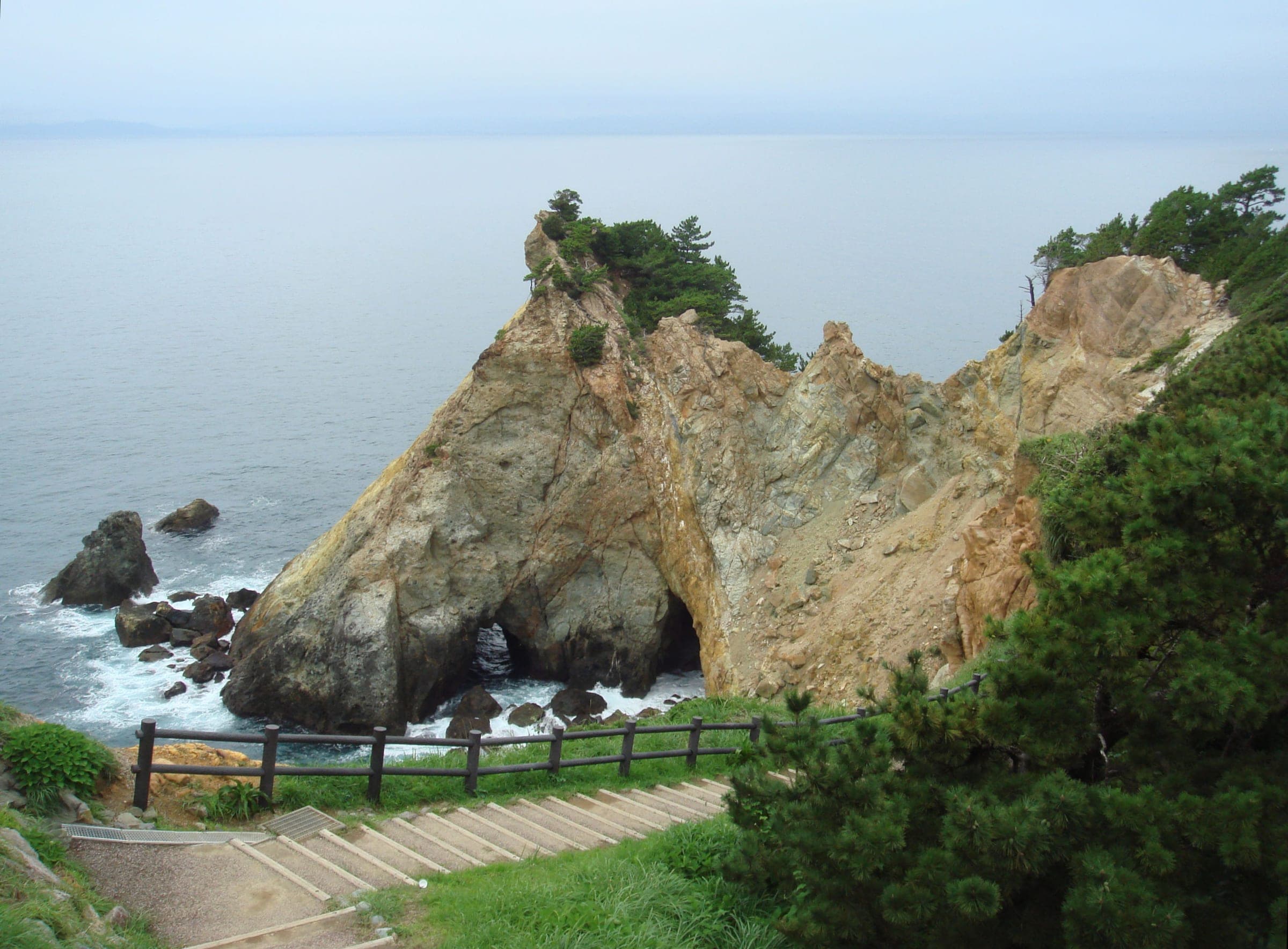
DogashimaView
White tuff islands and the Tensodo sea cave sit off the west coast here.
MatsuzakiTown
This west-coast town makes a good night stop between the two halves.
ShimodaTown
The loop turns north here at the peninsula's southern end.
Tokuzomaru ShimodaLunch
Tokuzomaru serves kinmedai by Izukyu-Shimoda Station.
Michi-no-eki Ito Marine TownLunch
The east-coast roadside station has bike racks and seafood lunches.
Ito Marine Town Seaside SpaBath
The same roadside station has a sea-view bath.
Michi-no-eki Izu Gateway KannamiCafe
This is the last big refuel stop at the top of the peninsula.
Every stop OpenStreetMap lists along the line (121): konbini, bike rental, cafés, drinking water, bike shops
- 7-ElevenKonbinikm 0.2
- HELLO CYCLINGBike rentalkm 0.3
- Numazu Station North Bicycle ParkingBike rentalkm 0.4
- ジョリーアンジュCaféskm 0.5
- 7-ElevenKonbinikm 0.7
- FamilyMartKonbinikm 0.8
- HELLO CYCLINGBike rentalkm 1
- FamilyMartKonbinikm 1
- 淡月居Caféskm 1.1
- DonguriCaféskm 1.1
- Doutor Coffee ShopCaféskm 1.2
- ファミリーマート沼津大手町店Konbinikm 1.2
- Daily YamazakiKonbinikm 1.2
- とも 沼津店Caféskm 1.3
- LawsonKonbinikm 1.3
- Numazu Grand HotelBike rentalkm 1.5
- 白馬Caféskm 1.6
- Daily YamazakiKonbinikm 1.9
- Numazu Riverside HotelBike rentalkm 2.1
- Numazu City HallBike rentalkm 2.5
- Seven-ElevenKonbinikm 3.2
- FamilyMartKonbinikm 3.5
- Argonkin StoreCaféskm 5.4
- 沼津御用邸記念公園Bike rentalkm 5.7
- Grandma シーサイド店Caféskm 9.5
- Cafe CELESTECaféskm 12.5
- HELLO CYCLINGBike rentalkm 14.4
- MinistopKonbinikm 14.9
- ShougetsuCaféskm 15.9
- てんてんCaféskm 16.6
- 峠の茶屋 アザセボラCaféskm 31.2
- 7-ElevenKonbinikm 40.8
- Umittake Yamatake StoreKonbinikm 41.1
- Sato StoreKonbinikm 41.1
- 7-ElevenKonbinikm 57.7
- Y Shop Morita Yagisawa StoreKonbinikm 60.2
- セブン-イレブン 西伊豆堂ヶ島店Konbinikm 76.7
- Windy Cafe & RestaurantCaféskm 76.8
- FamilyMartKonbinikm 78.4
- 7-ElevenKonbinikm 78.6
- FamilyMartKonbinikm 80
- KuraraCaféskm 80.8
- FamilyMartKonbinikm 81.1
- FamilyMartKonbinikm 110.6
- FamilyMartKonbinikm 112.8
- Perry BerryCaféskm 113
- 7-ElevenKonbinikm 113
- 7-ElevenKonbinikm 116.8
- FamilyMartKonbinikm 117.6
- LAWSONKonbinikm 120.3
- LawsonKonbinikm 121.3
- MarcoCaféskm 121.3
- Bakery Cafe PanetCaféskm 121.3
- らくらCaféskm 121.5
- 道の駅開国下田みなとBike rentalkm 122
- 7-ElevenKonbinikm 122.4
- Seven-ElevenKonbinikm 126
- CafésCaféskm 135.5
- FamilyMartKonbinikm 135.6
- Times CaféCaféskm 136.9
- Circle KKonbinikm 139.6
- 7-ElevenKonbinikm 141.7
- 7-ElevenKonbinikm 142.8
- 7-ElevenKonbinikm 147.8
- FamilyMartKonbinikm 150.1
- ザ.ナカヤKonbinikm 151.9
- Drinking waterDrinking waterkm 152.1
- Drinking waterDrinking waterkm 152.2
- LawsonKonbinikm 153.6
- Organic Cafe M2Caféskm 155.6
- Furusato CafeCaféskm 159
- 7ElevenKonbinikm 159.2
- 7-ElevenKonbinikm 160
- Dog Cafe & Deli (humans welcome)Caféskm 160.2
- LAWSONKonbinikm 160.3
- TokyuKonbinikm 160.6
- 7-ElevenKonbinikm 176.9
- LawsonKonbinikm 177.1
- Seven-Eleven Ito-Yukawa StoreKonbinikm 178.6
- LAWSONKonbinikm 182.2
- Seven-ElevenKonbinikm 182.5
- 7-ElevenKonbinikm 192.8
- Seven-ElevenKonbinikm 199.3
- Road Station Izu-no-HesoBike rentalkm 200.2
- 狩野川リバーサイドパークBike rentalkm 202.1
- FamilyMartKonbinikm 202.8
- 弘法の湯 長岡店Bike rentalkm 203.1
- 南山荘Bike rentalkm 203.1
- 7-ElevenKonbinikm 203.2
- Coffee &DollCaféskm 203.2
- Combini martKonbinikm 203.4
- Izunokuni City HallBike rentalkm 203.5
- ZacksCaféskm 203.5
- Izu Panorama ParkBike rentalkm 203.5
- FamilyMartKonbinikm 204.3
- アクシスかつらぎ(長岡総合会館)Bike rentalkm 204.8
- 弘法の湯 本店Bike rentalkm 205.3
- 守山西公園Bike rentalkm 206.2
- Road Side Station Izu Gate Way KannamiBike rentalkm 211.4
- Spoke CafeCaféskm 212
- 7-ElevenKonbinikm 212.1
- MINISTOPKonbinikm 212.7
- StarbucksCaféskm 214.8
- FamilyMartKonbinikm 215.7
- MINISTOPKonbinikm 216.9
- サイクルスポットBike shopskm 219.9
- 7-ElevenKonbinikm 220.1
- Cycle Base AsahiBike shopskm 220.8
- サイクルベースあさひ三島店Bike rentalkm 220.8
- StarbucksCaféskm 221
- 7-ElevenKonbinikm 221.2
- Seven-ElevenKonbinikm 221.5
- サントムーン柿田川 正面入口東側Bike rentalkm 222.3
- 柿田川公園 入口Bike rentalkm 222.5
- Drinking waterDrinking waterkm 222.6
- サントムーン柿田川 オアシス棟Bike rentalkm 222.9
- YOU CANBike shopskm 223.6
- 大岡駅南Bike rentalkm 226.2
- 7-ElevenKonbinikm 226.8
- 7-ElevenKonbinikm 227.9
- HELLO CYCLINGBike rentalkm 229.7
From OpenStreetMap, within each kind’s reach of the line. Opening hours change; check before you rely on one.
Ways off the route
NumazuRail
The JR Tokaido Line stops here at the start.
Izukyu-ShimodaRail
The Izukyu Line ends here, and it is the first station after the west coast.
KawazuRail
The Izukyu Line stops here.
Izu-AtagawaRail
The Izukyu Line stops here.
Izu-KogenRail
The Izukyu Line stops here.
ItoRail
The JR Ito Line and the Izukyu Line meet here.
Izu-NagaokaRail
The Izuhakone Railway stops here.
NumazuStation · km 0.9
IzukyushimodaStation · km 121.2
KawazuStation · km 135.9 · 377 m off the line
ImaihamakaiganStation · km 136.9
IzuinatoriStation · km 143.3
KataseshirataStation · km 147.6
IzuatagawaStation · km 150.1
Izu-HokkawaStation · km 151.5
Izu-OkawaStation · km 153.4 · 265 m off the line
Izu-KōgenStation · km 159.4 · 308 m off the line
JogasakikaiganStation · km 161.6 · 179 m off the line
FutoStation · km 165 · 277 m off the line
KawanaStation · km 171.5 · 295 m off the line
MinamiitoStation · km 177.3 · 1.9 km off the line
ItōStation · km 177.9 · 246 m off the line
UsamiStation · km 181.7 · 365 m off the line
MakinokōStation · km 198.5 · 1.9 km off the line
ŌhitoStation · km 199.7 · 1.7 km off the line
TakyōStation · km 200.5 · 522 m off the line
Izu-NagaokaStation · km 205 · 1.1 km off the line
NirayamaStation · km 207.2 · 666 m off the line
BarakiStation · km 208.6 · 711 m off the line
Izu-NittaStation · km 214.1 · 923 m off the line
DaibaStation · km 215.3 · 728 m off the line
Mishima-FutsukamachiStation · km 220.1 · 704 m off the line
Mishima-TamachiStation · km 220.8 · 784 m off the line
MishimaStation · km 221.3 · 1.8 km off the line
東海旅客鉄道
Mishima-HirokōjiStation · km 221.3 · 1.0 km off the line
Shimo-TogariStation · km 225.2 · 1.2 km off the line
OokaStation · km 226.2
Stations from OpenStreetMap within 2 km of the line. Check whether the line takes bikes before you plan to use it.
Tunnels
The line runs through 48 tunnels, 8.7 km in all; the longest is 1,000 m.
Rental near the start
Rent a bike for itレンタル
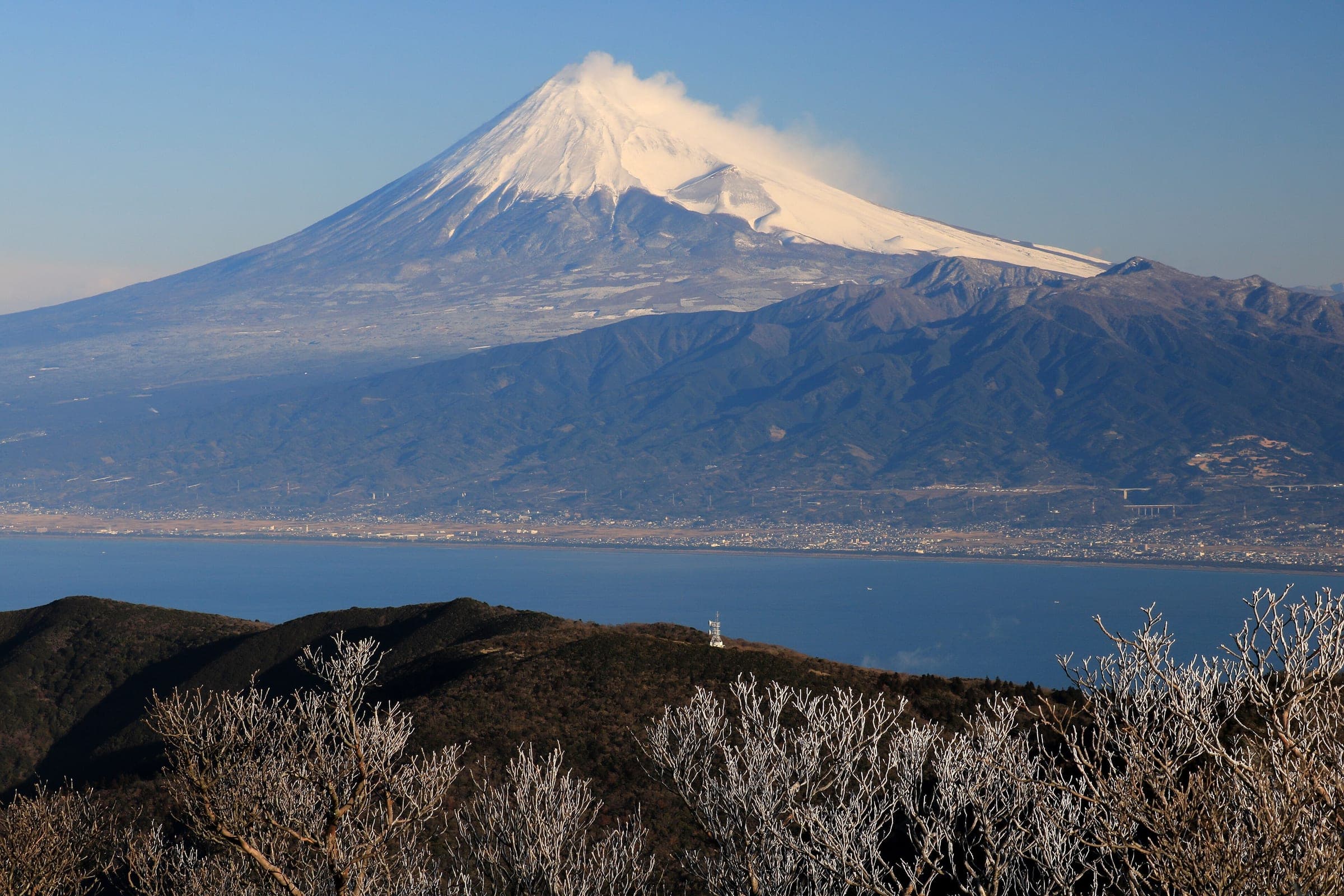
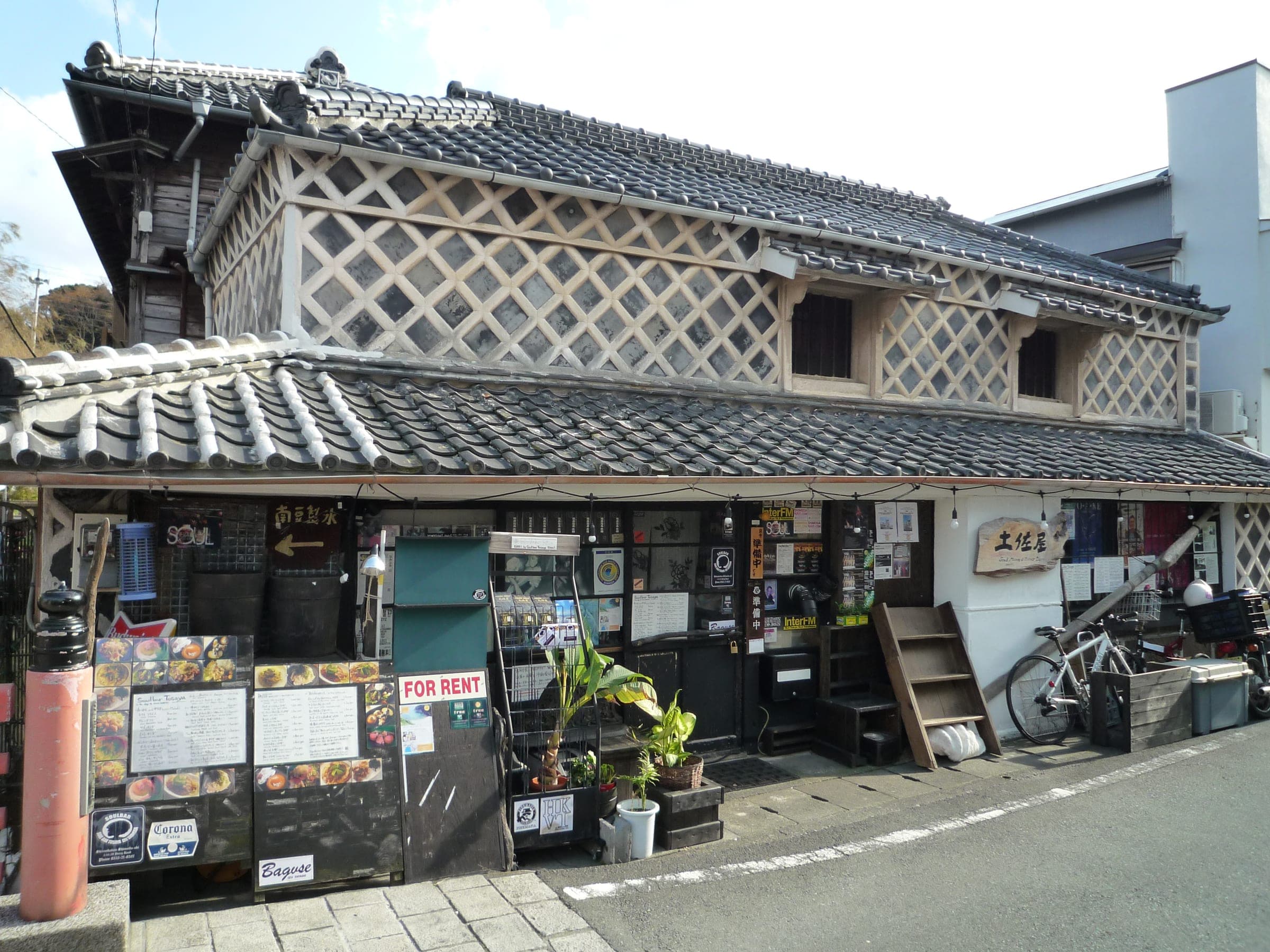
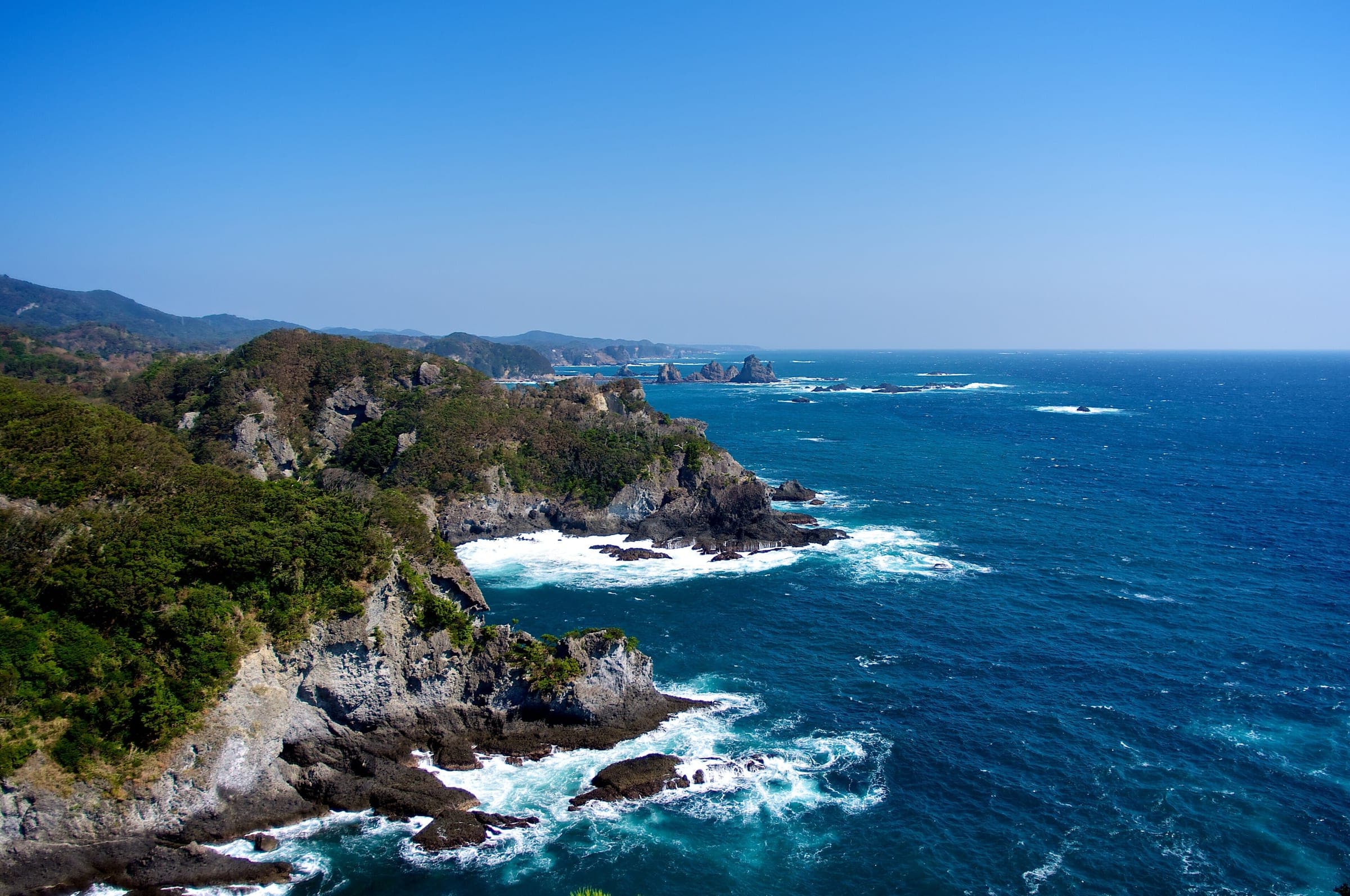
Shizuoka's tourism association publishes Izuichi as the prefecture's model route round the Izu Peninsula and rates it advanced. Its route data leaves Numazu Station, runs down the west coast past Toi and Dogashima to Matsuzaki and Shimoda, and comes back up the east coast through Kawazu and Ito before crossing inland to Izunokuni.
The prefecture has finished painting blue arrow markings along the whole loop as part of its work on the Pacific Cycling Road. It has added route signs and cycle pictograms. Warning boards stand at tunnels and on steep grades, and the prefecture certifies bicycle pits and cyclist-friendly inns along the way.
The association budgets just over 15 hours of riding time, so plan a night on the way; Matsuzaki and Shimoda both sit on the loop. It also suggests cycle trains and buses with bike racks for skipping parts of it, and on the east coast the Izukyu Line follows the shore from Ito to Shimoda.
If the full loop is too much, Toi's tourist office and Shimoda's tourism association both rent e-bikes on the route, and the association points to e-bike rental as the way in for riders less sure of their legs.
Worth knowing
- Ride it counter-clockwise as the prefecture draws it and you take the west coast while you're fresh.
- Book the night at Matsuzaki or Shimoda before you set out.
Quick answers about Izuichi Izu Peninsula Loopよくある質問
How long does it take to cycle around the Izu Peninsula?
Shizuoka's tourism association budgets 15 hours and 10 minutes of riding for the Izuichi loop round the Izu Peninsula. Split it over two days with a night in Matsuzaki or Shimoda.
Can you skip part of the Izu loop by train?
Yes. Shizuoka's tourism association suggests cycle trains and buses with bike racks for parts of the Izuichi loop, and on the east coast the Izukyu Line runs from Ito to Izukyu-Shimoda.
Where does Izuichi start?
At JR Numazu Station. Shizuoka's route data for Izuichi starts and finishes at Numazu Station on the Tokaido Line.
Where can you buy food and water on the Izuichi Izu Peninsula Loop ride?
OpenStreetMap lists konbini at 61 points within reach of the Izuichi Izu Peninsula Loop line, and drinking water at 3. The longest stretch without konbini is 29.5 km, so carry what you need for it.
Which way should you ride Izuichi Izu Peninsula Loop in April to May and October to November?
In April to May and October to November the most frequent wind at the nearest weather station blows from the west-south-west at about 2.8 m/s on average. By our calculation the Izuichi Izu Peninsula Loop ride finishes with less headwind either way.
How busy are the roads on the Izuichi Izu Peninsula Loop ride?
By road class in OpenStreetMap, 21% of the Izuichi Izu Peninsula Loop ride runs on quiet roads or paths and 69% on trunk or primary roads.
Within 8 km
Places to stay nearby宿
Within 8 km