Pacific Cycling Road Stage 5 from Toba to the Kumano River
太平洋岸自転車道 三重県区間(鳥羽〜熊野川)34°29′ N 136°51′ E198.7 km · 2,858 m up · 7% quiet roadsHardRoad bike, Touring
Stage 5 of the Pacific Cycling Road crosses Mie from the ferry at Toba down the Ise-Shima and Kumano-nada coasts to the Kumano River at the Wakayama border, and it suits riders who like ria coast with steep coves between long beaches. From Toba the council offers a coastal course and an inland one, which meet at Kii-Nagashima; this stage traces the coastal course.
Photo Saigen Jiro · Wikimedia Commons · CC0 and others, credited in the gallery
HardStageRoad bike, Touring, E-bike
KonbiniDrinking waterToiletsBike shopsTop of chart 450 m
Routed over OpenStreetMap with BRouter trekking and measured against Copernicus DEM GLO-30 30 m on 2026-10-12. 10.2 km crosses bridges or water, where the elevation is drawn straight across. 19.4 km runs through tunnels, drawn straight through the hill.
On the road
- Start
- Toba port (Ise-wan Ferry). The Toba ferry terminal has a cycle station with bike racks, coin lockers and free Wi-Fi, and Toba Station is Mie's gateway.
- Finish
- Kumano River at Shingu. Across the river the line enters Wakayama at Shingu, where Stage 6 begins, and JR Shingu Station sits close to the bridge.
- Getting there
- Ise-wan Ferry, Atsumi Line cycle train, Kintetsu rinko and cycle trains
- In winter
- JMA's 1991–2020 normals give Owase a January mean of 6.5 °C with a mean high of 11.5 °C, and January brings about a quarter of August's rain.
- In summer
- JMA's normals give Owase 427.3 mm of rain in August. Expect downpours, and ride early in the heat.
- In typhoon
- Typhoons reach the Kumano-nada coast in late summer and autumn. Check JMA's warnings before the exposed stretch south of Owase.
Ride safely
- Between Ago Bay and Kii-Nagashima the coastal course has no railway, so pack a rinko bag and plan food stops in the larger coves.
- The Kumano-nada coast roads pass through tunnels; run front and rear lights through each one.
- The council's map sets out the rules for the whole route: keep to the left of the carriageway, never ride two abreast, switch lights on at night and in every tunnel, and wear a helmet.
- The council's map warns that bikes go missing from racks at stops along the route, so lock yours even for a quick coffee.
Wind at Hikone, 1991-2020 normals
Which way to ride, month by month風
Jan
NW 3.7
–
Feb
NW 4
–
Mar
NW 3.3
–
Apr
NW 2.8
–
May
NW 2.5
–
Jun
NW 2.4
–
Jul
NW 2.5
–
Aug
NW 2.5
–
Sep
NW 2.9
–
Oct
NW 3.1
–
Nov
NW 2.9
–
Dec
SSE 3.7
–
Arrows point the way the wind blows. Speeds are monthly means in m/s. The wind on any day can differ from the monthly pattern, so check the forecast.
Every stop OpenStreetMap lists along the line (44): bike rental, cafés, konbini
- 中之郷駅前(鳥羽水族館前)Bike rentalkm 0.2
- ChangeCaféskm 0.4
- FamilyMartKonbinikm 2
- FamilyMartKonbinikm 28.7
- モデレートCaféskm 31.2
- FamilyMartKonbinikm 31.5
- イーストポイントCaféskm 32.7
- 喫茶&軽食 ベルパールCaféskm 33.1
- LawsonKonbinikm 33.8
- FamilyMartKonbinikm 34.1
- 杉の子Caféskm 34.2
- 鵜方駅北側Bike rentalkm 34.2
- FamilyMartKonbinikm 34.3
- FamilyMartKonbinikm 34.6
- タイムボカンCaféskm 34.9
- LawsonKonbinikm 35.2
- たばこKonbinikm 39.4
- FamilyMartKonbinikm 43.7
- Circle KKonbinikm 63
- グリーン&グリーンCaféskm 63
- 珈琲塔 FIVECaféskm 63.4
- FamilyMartKonbinikm 64.4
- LawsonKonbinikm 88
- FamilyMartKonbinikm 109.7
- ラベンダーCaféskm 118.7
- 樹林Caféskm 118.7
- FamilyMartKonbinikm 137.2
- FamilyMartKonbinikm 144.3
- ブーCaféskm 145.1
- FamilyMartKonbinikm 145.2
- Cozy CafeCaféskm 145.3
- Komeda's CoffeeCaféskm 145.5
- FamilyMartKonbinikm 146.1
- Live Club Blue MoonCaféskm 147.1
- FamilyMartKonbinikm 147.7
- 喫茶PCaféskm 177.5
- 喫茶お食事 山茶郷Caféskm 177.9
- Hane CafeCaféskm 178.2
- FamilyMartKonbinikm 178.7
- LawsonKonbinikm 179.2
- FamilyMartKonbinikm 182.4
- メルシーCaféskm 196.7
- LAWSONKonbinikm 196.8
- FamilyMartKonbinikm 197
From OpenStreetMap, within each kind’s reach of the line. Opening hours change; check before you rely on one.
Ways off the route
TobaRail
JR Sangu Line and Kintetsu Toba Line, and Mie's council gateway.
KashikojimaRail
Kintetsu Shima Line terminus. Kintetsu local trains carry unbagged bikes to Matsusaka.
Kii-NagashimaRail
JR Kisei Line, where the coastal and inland courses meet.
OwaseRail
JR Kisei Line.
KumanoshiRail
JR Kisei Line, near Onigajo and Shichiri Mihama.
ShinguRail
JR Kisei Line across the Kumano River, where JR West's cycle trains start.
Ago Bay boat from Wagu to KashikojimaFerry
Shima Marine Leisure's regular boat takes a limited number of bikes for a fee.
TobaStation · km 0 · 708 m off the line
JR東海
NakanogouStation · km 0.1
Shima-akasakiStation · km 1 · 482 m off the line
HunatsuStation · km 1.5 · 1.4 km off the line
Shima-ShimmeiStation · km 34 · 1.4 km off the line
UgataStation · km 34.1
Shima-YokoyamaStation · km 34.7 · 624 m off the line
Kintetsu Corporation
Kii-NagashimaStation · km 118.6
MinoseStation · km 126.5
FunatsuStation · km 132.9 · 195 m off the line
AigaStation · km 137.6 · 314 m off the line
JR 東海旅客鉄道
OwaseStation · km 144.6 · 158 m off the line
尾鷲駅Station · km 144.6 · 172 m off the line
HadasuStation · km 174 · 1.8 km off the line
OdomariStation · km 174.5 · 218 m off the line
KumanoshiStation · km 177.4 · 363 m off the line
AriiStation · km 179.3 · 282 m off the line
KoshiyamaStation · km 183.8
Kii-IchigiStation · km 185.4
AtawaStation · km 188.2
Kii-IdaStation · km 193.5
UdonoStation · km 195.5 · 955 m off the line
ShinguStation · km 198.6 · 1.2 km off the line
Stations from OpenStreetMap within 2 km of the line. Check whether the line takes bikes before you plan to use it.
Tunnels
The line runs through 48 tunnels, 19.4 km in all; the longest is 2,325 m.
South of Toba the coastal course heads round the Shima Peninsula to Ago Bay, where Yokoyama Observatory looks over the inlets and islands of what Mie's site calls one of Japan's finest ria coasts. Mie's first model course follows this stretch from the Toba ferry terminal to the observatory.
From Ago Bay the line runs west along the Minami-Ise coast, a long chain of fishing coves with no railway, and joins the inland course at Kii-Nagashima. From there it meets the Kisei Main Line again and again on its way south through Owase and Kumano. The council names the sea-carved cliffs of Onigajo and the long beach of Shichiri Mihama before the Kumano River.
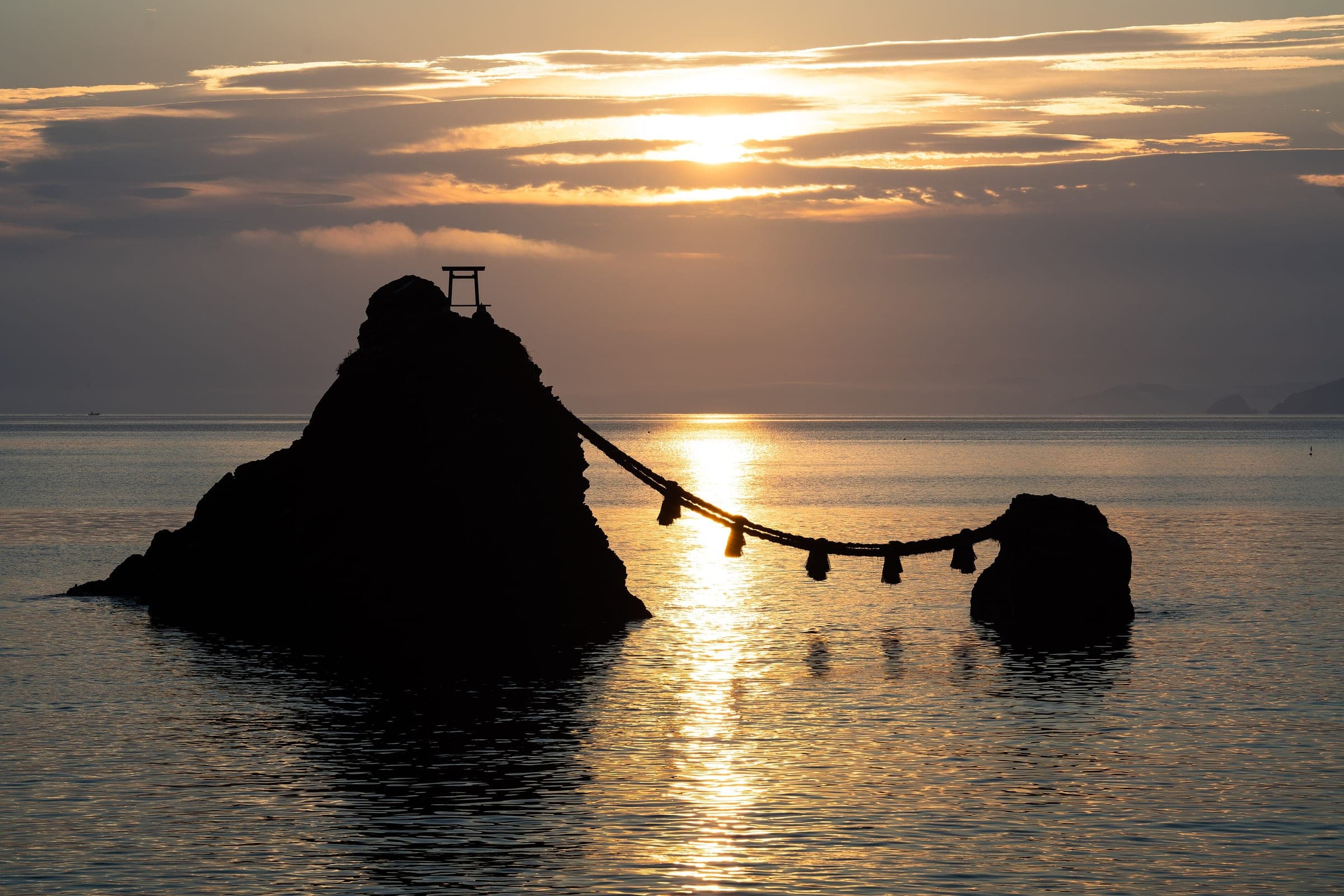
The inland course from Toba runs by Futami and Ise, then through Watarai and Odai. MLIT notes that at Futami's Meoto Iwa the sun rises between the two rocks from May to July and the moon from November to January around the full moon.
Worth knowing
- Kintetsu carries unbagged bikes on local trains between Matsusaka and Kashikojima with no fee, so you can ride Shima's coast as a day trip by train.
- The Ago Bay boat between Kashikojima and Wagu takes a limited number of bikes for a fee, according to the council's table.
- Mie's own site, mie-cycling-road.jp, splits the Ise-Shima coast into model day rides with stops and timings.
Quick answers about Pacific Cycling Road Stage 5 from Toba to the Kumano Riverよくある質問
Which way does the Pacific Cycling Road go south of Toba?
Either way. The council offers a coastal course through Shima and Minami-Ise and an inland course through Ise, Watarai and Odai, and the two meet at Kii-Nagashima. This stage follows the coastal one.
Can you take a bike on Kintetsu in Ise-Shima?
Yes. The council's cycle train list says Kintetsu local trains between Matsusaka and Kashikojima carry bikes unbagged with no fee and no booking.
How long is the Pacific Cycling Road Stage 5 from Toba to the Kumano River ride?
The Pacific Cycling Road Stage 5 from Toba to the Kumano River ride is 198.7 km with 2,858 m of climbing by our route data, routed over OpenStreetMap and measured against Copernicus DEM GLO-30 30 m. The highest point is 423 m, and the steepest 200 m averages 13.3%.
Where can you buy food and water on the Pacific Cycling Road Stage 5 from Toba to the Kumano River ride?
OpenStreetMap lists konbini at 24 points within reach of the Pacific Cycling Road Stage 5 from Toba to the Kumano River line, and drinking water at none. The longest stretch without konbini is 31 km, so carry what you need for it.
Which way should you ride Pacific Cycling Road Stage 5 from Toba to the Kumano River in April to May and October to November?
In April to May and October to November the most frequent wind at the nearest weather station blows from the north-west at about 2.8 m/s on average. By our calculation the Pacific Cycling Road Stage 5 from Toba to the Kumano River ride finishes with less headwind either way.