Pacific Cycling Road Stage 1 from Choshi to Hamakanaya
太平洋岸自転車道 千葉県区間(銚子〜浜金谷)35°44′ N 140°50′ E224.7 km · 969 m up · 20% quiet roadsHardRoad bike, Touring
Stage 1 of the Pacific Cycling Road takes the whole Chiba coast from Choshi Station round the Boso Peninsula to the Tokyo Wan Ferry at Hamakanaya, and it suits riders who like flat beach roads first and a rolling coast after. Wind costs you most on the open Kujukuri shore, where JMA's normals give Choshi a west-north-west prevailing wind all winter.
Road closure
The JR Uchibo line runs a reduced service after Typhoon No. 25
Typhoon No. 25 damaged the JR Uchibo line in late September 2026. From 5 October trains run between Kisarazu and Awa-Kamogawa at about half the usual frequency, and a replacement bus covers the cut between Anegasaki and Nagaura. Plan extra time for rinko trips to Tateyama and the southern Boso coast, and check JR East's notices before you travel.
Checked 2026-10-11 · tateyamacity.com
Road closure
Landslides close part of Route 127 between Kanaya and Hota on the Boso coast
Typhoon No. 25 brought landslides that closed part of National Route 127 between Hama-Kanaya and Hota in autumn 2026, along with prefectural road 182. Nihon-ji asks drivers heading to Nokogiriyama to come in from the Kyonan-Hota interchange. The Pacific Cycling Road follows Route 127 here, so riders take the detour until the road reopens.
Checked 2026-10-11 · nihonji.jp
Photo Σ64 · Wikimedia Commons · CC BY 3.0 and others, credited in the gallery
HardStageRoad bike, Touring, E-bike
KonbiniDrinking waterToiletsBike shopsTop of chart 100 m
Routed over OpenStreetMap with BRouter trekking and measured against Copernicus DEM GLO-30 30 m on 2026-10-12. 8.7 km crosses bridges or water, where the elevation is drawn straight across. 7 km runs through tunnels, drawn straight through the hill.
On the road
- Wind
- JMA's 1991–2020 normals give Choshi a prevailing west-north-west wind from December to February, averaging 6.0 m/s in February. On the Kujukuri shore that wind comes off the land across the beach road.
- Start
- Choshi Station. JR Choshi Station is the official start of the whole route and a gateway with the Choshi tourist association's office. B.B.BASE runs here from Ryogoku on its Sakura and Choshi service, so the bike arrives assembled.
- Finish
- Hamakanaya port (Tokyo Wan Ferry). The ferry leaves here for Kurihama, where Stage 2 begins. JR Hamakanaya Station on the Uchibo Line is a short walk from the terminal.
- Getting there
- B.B.BASE
- In winter
- Chiba promotes cycling all year because the coast stays warm and low. JMA's 1991–2020 normals give Choshi a January mean of 6.6 °C with a mean high of 10.1 °C. Plan short days around the early sunset.
- In spring
- The Minamiboso coast between Wadaura and Tateyama is promoted as the Hana Kaido, the flower road, and spring is when it earns the name.
- In summer
- August averages 25.5 °C at Choshi by JMA's normals. Start at dawn and carry water along Kujukuri, where the beach road has little cover.
- In typhoon
- Typhoons reach the Boso coast in late summer and autumn. Check JMA's warnings and Tokyo Wan Ferry's service notices before you set out.
Ride safely
- Route 127 on the Uchibo coast passes through narrow tunnels in Kyonan. Switch on front and rear lights before each one and hold your line.
- Between Iioka and Kazusa-Ichinomiya the beach road runs well away from the railway, which sits inland on the Togane and Sotobo lines. Carry food and water for that stretch.
- The council's repair list for Chiba names shops in Katsuura, Ichinomiya and Tateyama only, so carry a spare tube and tools.
- The council's map sets out the rules for the whole route: keep to the left of the carriageway, never ride two abreast, switch lights on at night and in every tunnel, and wear a helmet.
Wind at Ajiro, 1991-2020 normals
Which way to ride, month by month風
Jan
WSW 3.4
–
Feb
WSW 3.2
–
Mar
NNE 3.3
–
Apr
WSW 3.1
–
May
WSW 2.6
–
Jun
WSW 2.3
–
Jul
WSW 2.5
–
Aug
WSW 2.4
–
Sep
NNE 2.5
–
Oct
NNE 2.8
–
Nov
NNE 2.7
–
Dec
WSW 3.3
–
Arrows point the way the wind blows. Speeds are monthly means in m/s. The wind on any day can differ from the monthly pattern, so check the forecast.
Every stop OpenStreetMap lists along the line (85): bike rental, konbini, cafés, bike shops, drinking water
- Choushi Tourist Information CentreBike rentalkm 0
- NewDaysKonbinikm 0
- CafésCaféskm 0.1
- Cycle Shop IssindoBike shopskm 0.2
- Around the cornerCaféskm 0.7
- Drinking waterDrinking waterkm 0.8
- Grow CafeCaféskm 0.9
- LawsonKonbinikm 1.4
- LawsonKonbinikm 3.2
- FamilyMartKonbinikm 4.3
- Drinking waterDrinking waterkm 6.9
- Drinking waterDrinking waterkm 7.3
- 7-ElevenKonbinikm 8.3
- 風のアトリエCaféskm 9.1
- 7-ElevenKonbinikm 10.3
- 7-ElevenKonbinikm 15.2
- Canadian Coffee HouseCaféskm 15.8
- MinistopKonbinikm 17
- Yamazaki ShopKonbinikm 19.6
- LawsonKonbinikm 21.7
- 7-ElevenKonbinikm 24
- 7-ElevenKonbinikm 43.9
- 7-ElevenKonbinikm 51.9
- Propeller CafeCaféskm 52
- はるやま茶屋Caféskm 53.8
- 7-ElevenKonbinikm 62.1
- 7-ElevenKonbinikm 65
- FamilyMartKonbinikm 66.1
- 7-ElevenKonbinikm 67.8
- FamilyMartKonbinikm 69.1
- セブンイレブン白子インター前店Konbinikm 73.8
- FamilyMart (Eating space)Konbinikm 77.7
- LAWSON ICHINOMIYA-KAIGANKonbinikm 81.1
- Family MartKonbinikm 82.6
- DonnerCaféskm 96.4
- MINISTOP (Eating space)Konbinikm 98
- Seven-ElevenKonbinikm 101.5
- LawsonKonbinikm 105.3
- Seven-Eleven (Eating space)Konbinikm 106.7
- Seven-ElevenKonbinikm 109.1
- セブン-イレブン 勝浦武道大学前店Konbinikm 111.5
- Acco CafeCaféskm 113.4
- Banzai CafeCaféskm 114.5
- Seven-ElevenKonbinikm 118.6
- LawsonKonbinikm 125.5
- 7-ElevenKonbinikm 125.8
- FamilyMartKonbinikm 127.9
- Yamazaki ShopKonbinikm 131
- LawsonKonbinikm 132.9
- Earth Tree CafeCaféskm 134.3
- 7-ElevenKonbinikm 135.4
- Nonkey's CafeCaféskm 135.8
- KAMO KitchenCaféskm 136.1
- 心太屋Caféskm 142.2
- Ebiya CafeCaféskm 142.4
- LawsonKonbinikm 148.4
- 7-ElevenKonbinikm 151.3
- FamilyMartKonbinikm 158.5
- 7-ElevenKonbinikm 158.9
- Yamazaki ShopKonbinikm 169.2
- Inaba StoreKonbinikm 171.5
- OliveCaféskm 171.6
- 南房パラダイス 喫茶フローラCaféskm 181.6
- ふしぎな岬のカフェ 千の光Caféskm 189.5
- 7-ElevenKonbinikm 195.8
- FamilyMartKonbinikm 197.1
- 7-ElevenKonbinikm 197.7
- 7-ElevenKonbinikm 198.6
- なぎちゃりBike rentalkm 199.1
- SEA DAYSCaféskm 200.2
- 7-ElevenKonbinikm 200.3
- 7-ElevenKonbinikm 202.6
- 7-ElevenKonbinikm 206.3
- Le RisaCaféskm 206.3
- エンゼルCaféskm 208.4
- 7-ElevenKonbinikm 213.2
- LawsonKonbinikm 214.4
- 7-ElevenKonbinikm 216.1
- FamilyMartKonbinikm 217
- オアシスブルーカフェCaféskm 218.5
- みゆきCaféskm 220.5
- 7-ElevenKonbinikm 221
- Music and Coffee Shop MisakiCaféskm 222.7
- cafe edomonsCaféskm 224.3
- 7-ElevenKonbinikm 224.4
From OpenStreetMap, within each kind’s reach of the line. Opening hours change; check before you rely on one.
Ways off the route
ChoshiRail
JR Sobu Main Line and the Choshi Electric Railway. B.B.BASE serves Choshi on its Sakura and Choshi service.
IiokaRail
JR Sobu Main Line, inland of the north end of the Kujukuri shore.
Kazusa-IchinomiyaRail
JR Sotobo Line and an official gateway with a tourist office.
OharaRail
JR Sotobo Line.
KatsuuraRail
JR Sotobo Line and an official gateway.
Awa-KamogawaRail
JR Sotobo and Uchibo lines and an official gateway. B.B.BASE runs here on its Sotobo service.
WadauraRail
JR Uchibo Line. B.B.BASE runs here on its Uchibo service.
TateyamaRail
JR Uchibo Line and an official gateway. B.B.BASE runs here on its Uchibo service.
HamakanayaRail
JR Uchibo Line, a short walk from the ferry terminal.
Tokyo Wan Ferry from Hamakanaya to KurihamaFerry
About 40 minutes across the mouth of Tokyo Bay. Bikes pay a handling fee and need no booking; a bagged bike rides on a passenger ticket.
ChōshiStation · km 0
東日本旅客鉄道
NakanochoStation · km 0 · 557 m off the line
銚子電気鉄道
KannonStation · km 1.8 · 411 m off the line
銚子電気鉄道
Moto-ChoshiStation · km 2.3 · 301 m off the line
Kasagami-KurohaeStation · km 5 · 755 m off the line
Nishi-AshikajimaStation · km 5.1 · 626 m off the line
AshikajimaStation · km 5.8 · 469 m off the line
KimigahamaStation · km 7.1 · 397 m off the line
InuboStation · km 8.1
TokawaStation · km 8.2 · 763 m off the line
ToramiStation · km 85.7 · 1.3 km off the line
東日本旅客鉄道
TaitoStation · km 87.9 · 1.8 km off the line
東日本旅客鉄道
ChojamachiStation · km 91.5 · 1.0 km off the line
東日本旅客鉄道
MikadoStation · km 94.3 · 1.0 km off the line
東日本旅客鉄道
Nishi-OharaStation · km 97.3 · 1.6 km off the line
ŌharaStation · km 98 · 487 m off the line
いすみ鉄道
OharaStation · km 98.1 · 455 m off the line
東日本旅客鉄道
NamihanaStation · km 101.6 · 275 m off the line
東日本旅客鉄道
OnjukuStation · km 106.4 · 283 m off the line
東日本旅客鉄道
KatsuuraStation · km 112 · 555 m off the line
東日本旅客鉄道
UbaraStation · km 115.7
東日本旅客鉄道
Kazusa-OkitsuStation · km 118.5 · 341 m off the line
東日本旅客鉄道
Namegawa-IslandStation · km 122
東日本旅客鉄道
Awa-KominatoStation · km 125.8
東日本旅客鉄道
Awa-AmatsuStation · km 130 · 310 m off the line
東日本旅客鉄道
Awa-KamogawaStation · km 135.4
東日本旅客鉄道
FutomiStation · km 138.9
東日本旅客鉄道
EmiStation · km 144 · 309 m off the line
東日本旅客鉄道
WadauraStation · km 148.4
東日本旅客鉄道
MinamiharaStation · km 152.9 · 752 m off the line
東日本旅客鉄道
ChitoseStation · km 156.3
東日本旅客鉄道
ChikuraStation · km 158.3 · 769 m off the line
東日本旅客鉄道
TateyamaStation · km 200 · 322 m off the line
東日本旅客鉄道
Nako-FunakataStation · km 203.6 · 255 m off the line
東日本旅客鉄道
TomiuraStation · km 206.9 · 229 m off the line
東日本旅客鉄道
IwaiStation · km 213.7
東日本旅客鉄道
Awa-KatsuyamaStation · km 216.9
HotaStation · km 220.3
東日本旅客鉄道
Hama-KanayaStation · km 224.3
東日本旅客鉄道
Stations from OpenStreetMap within 2 km of the line. Check whether the line takes bikes before you plan to use it.
Tunnels
The line runs through 43 tunnels, 7.0 km in all; the longest is 575 m.
- Route 127 tunnels in KyonanMLIT's National Cycle Route guide uses a narrow tunnel on Route 127 in Kyonan as its example of signs that warn drivers about cyclists. Ride with front and rear lights on.
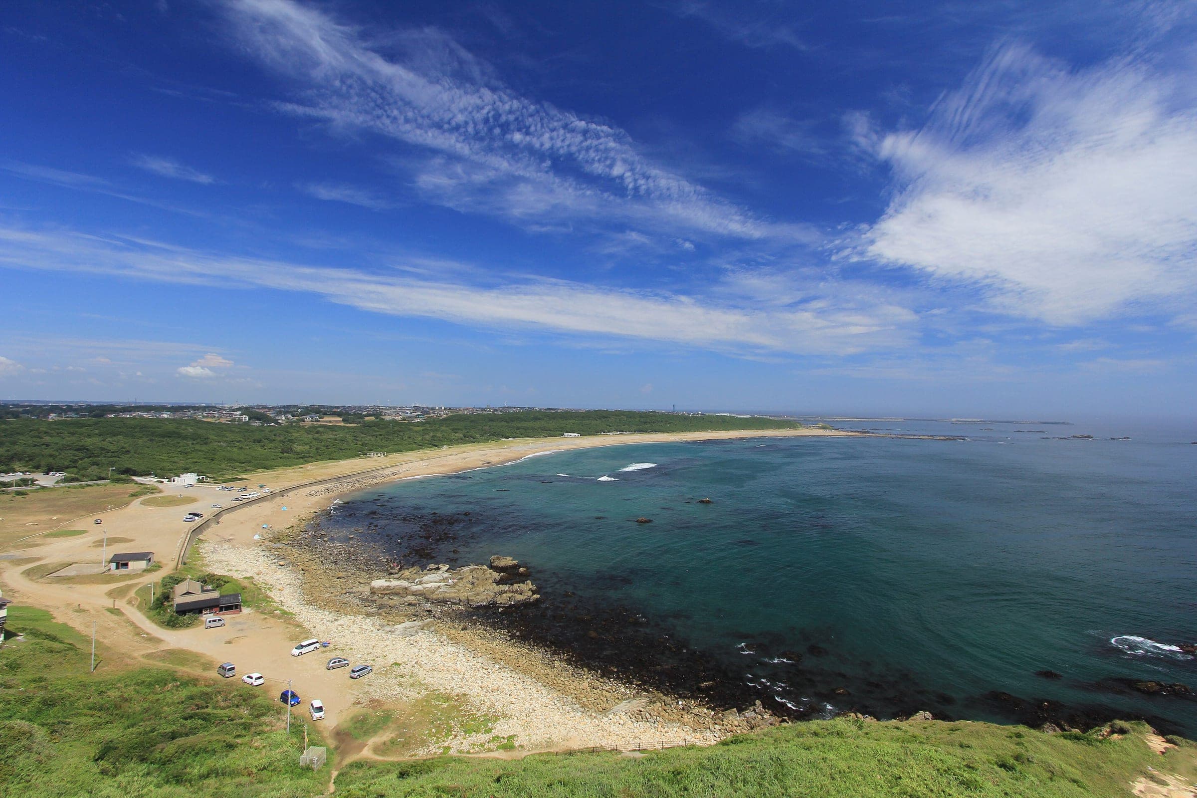
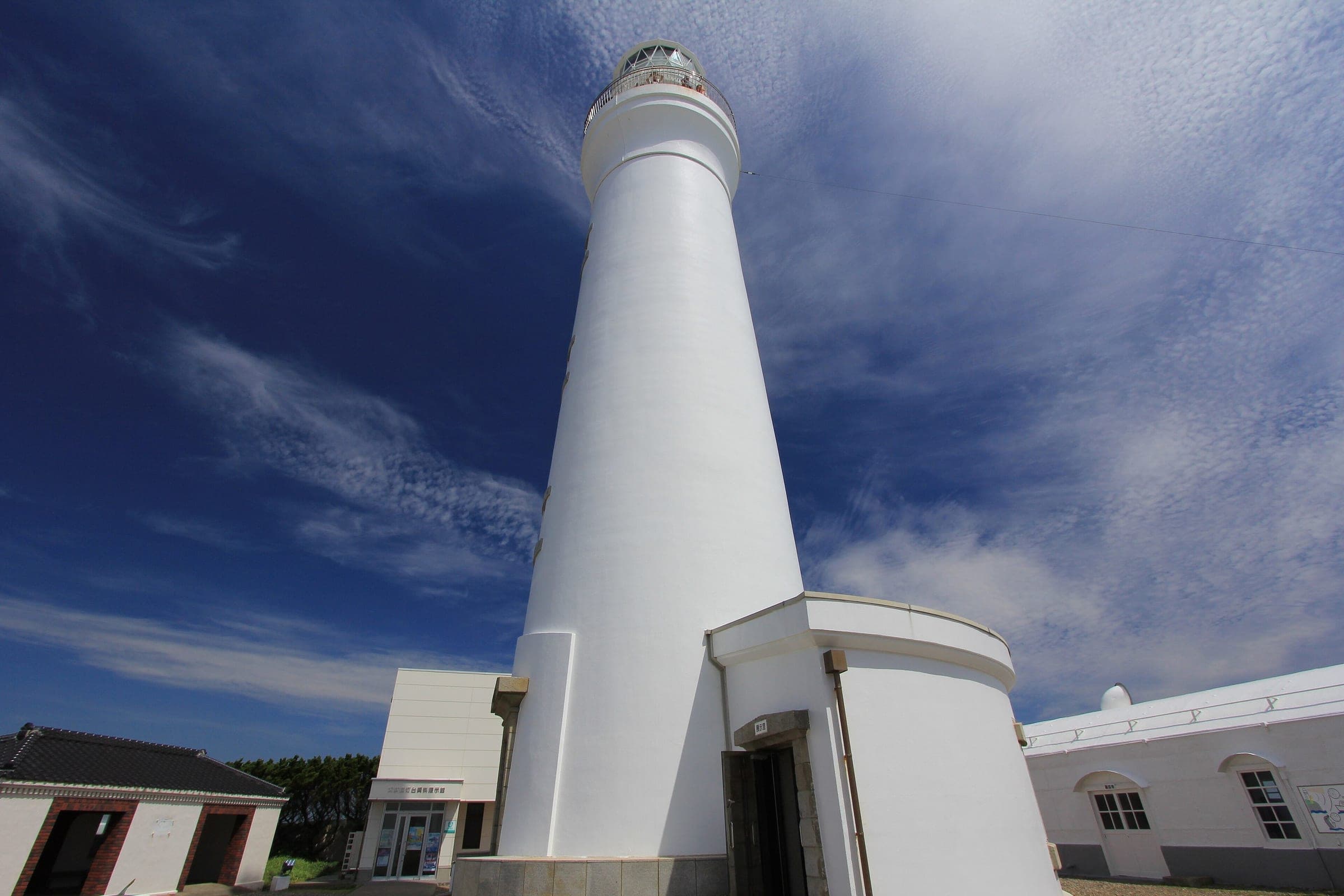
The line leaves Choshi for Inubozaki, where MLIT says the lighthouse headland sees Japan's earliest sunrise outside the mountains and remote islands. From Iioka it drops onto the Kujukuri shore and follows the sand south to Cape Taito. Chiba built two prefectural cycleways here for the original plan, Route 408 from Iioka to Kujukuri and Route 405 on toward Isumi, and the beach road stays flat the whole way.
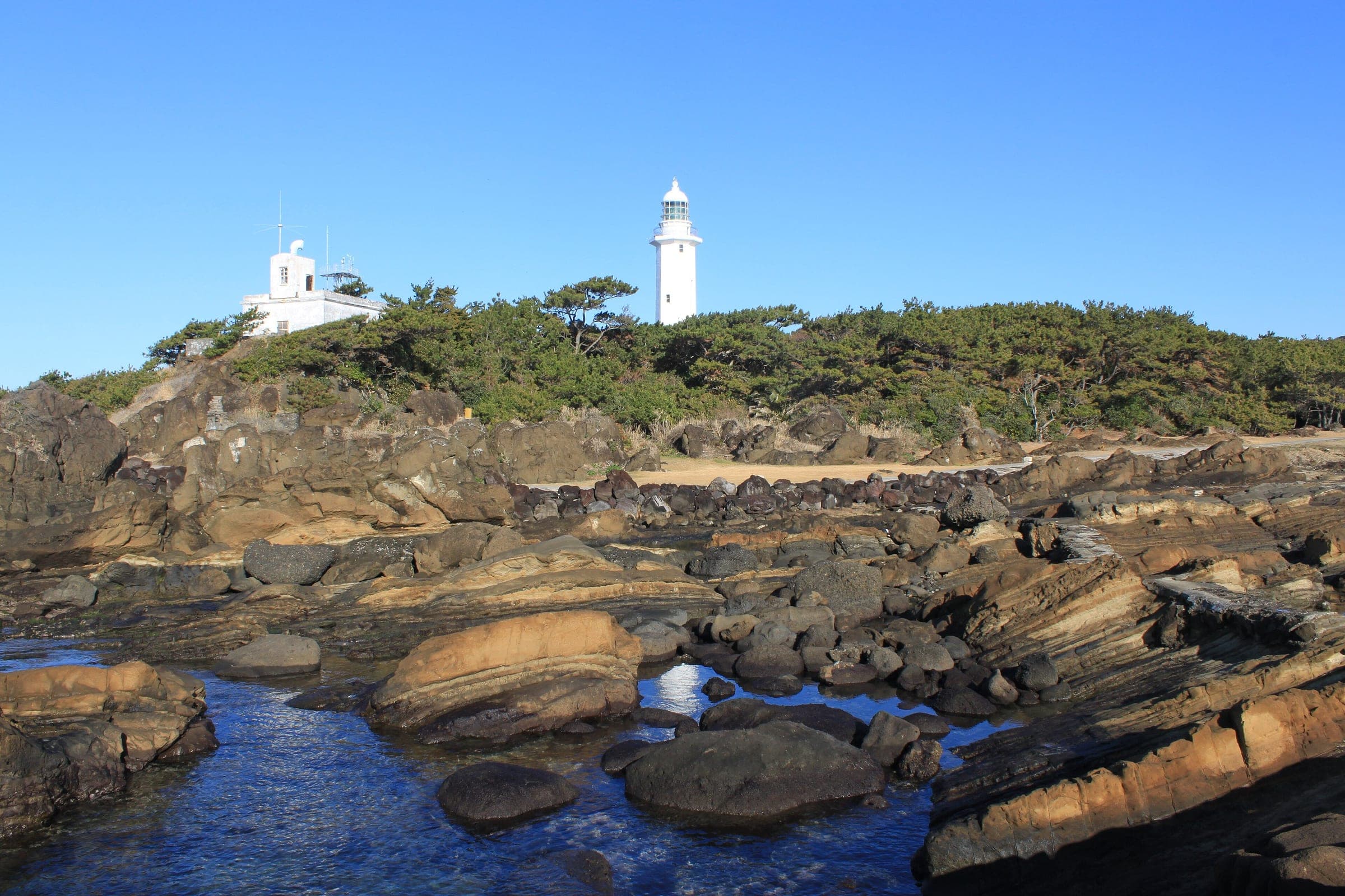
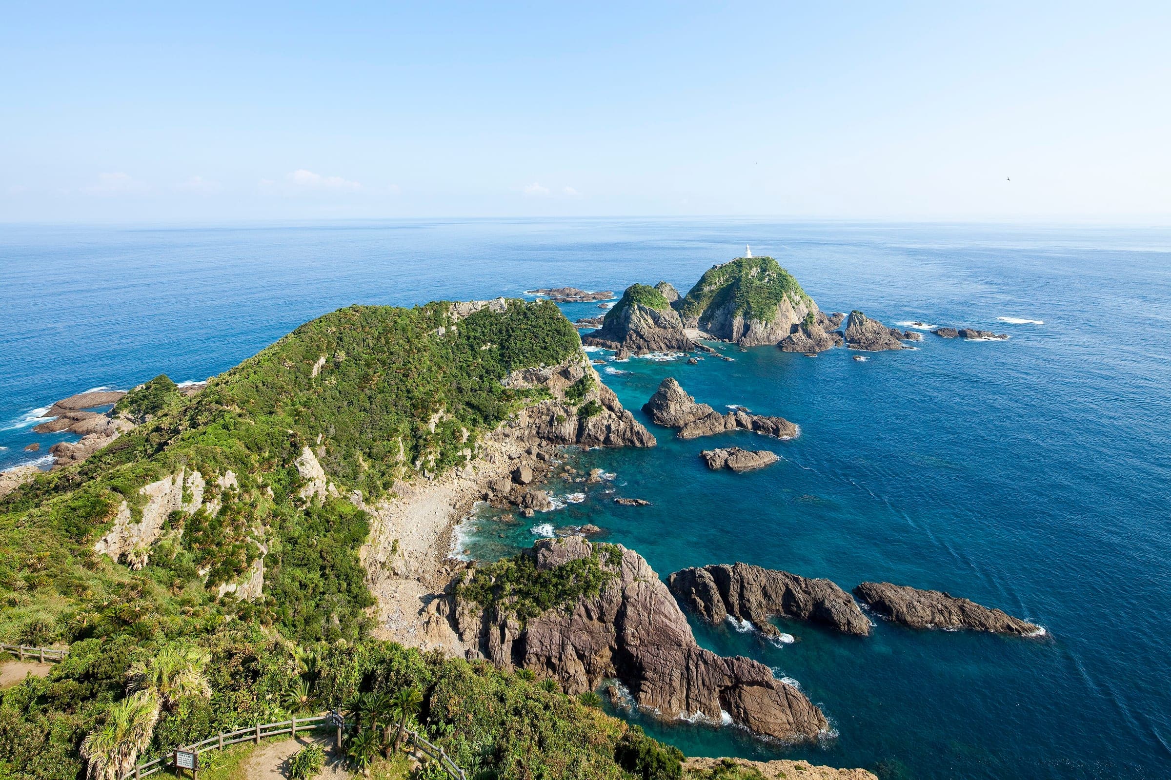
South of Cape Taito the coast turns rocky and the road starts to roll through Ohara, Onjuku, Katsuura and Kamogawa. Katsuura and Awa-Kamogawa stations both serve as official gateways. Round the southern tip the line passes Nojimazaki lighthouse and turns north to Tateyama, another gateway, and the council points riders to Haraoka pier in Minamiboso, an old wooden jetty that photographers seek out at sunset.
The last stretch follows Route 127 up the Uchibo coast through Kyonan to Kanaya, where the Mt. Nokogiri ropeway starts beside the road and the ferry waits. Michi-no-Eki Hota Shogakko, a closed primary school that now works as a roadside station, makes a good last stop before the boat.
Worth knowing
- Book B.B.BASE seats ahead. The council lists it as reserved-seat only, with services from Ryogoku to Choshi, Awa-Kamogawa, Wadaura and Tateyama.
- Split the stage at Katsuura or Awa-Kamogawa, where the stations double as council gateways.
- At Hamakanaya buy your ticket at the terminal and wheel the bike aboard. Tokyo Wan Ferry charges a bike fee and takes no bookings.
Quick answers about Pacific Cycling Road Stage 1 from Choshi to Hamakanayaよくある質問
How do you get to the start of the Pacific Cycling Road at Choshi?
Take JR to Choshi Station, the official start. B.B.BASE, JR East's cycle train, runs from Ryogoku to Choshi on reserved seats, so the bike travels assembled.
Is the Chiba stage of the Pacific Cycling Road flat?
Mostly. The Kujukuri shore from Iioka to Cape Taito is flat beach road, and the coast south of Cape Taito through Katsuura and Kamogawa rolls more.
How long is the Pacific Cycling Road Stage 1 from Choshi to Hamakanaya ride?
The Pacific Cycling Road Stage 1 from Choshi to Hamakanaya ride is 224.7 km with 969 m of climbing by our route data, routed over OpenStreetMap and measured against Copernicus DEM GLO-30 30 m. The highest point is 67 m, and the steepest 200 m averages 12.7%.
Where can you buy food and water on the Pacific Cycling Road Stage 1 from Choshi to Hamakanaya ride?
OpenStreetMap lists konbini at 54 points within reach of the Pacific Cycling Road Stage 1 from Choshi to Hamakanaya line, and drinking water at 3. The longest stretch without konbini is 24.3 km, so carry what you need for it.
Which way should you ride Pacific Cycling Road Stage 1 from Choshi to Hamakanaya in April to May and October to November?
In April to May and October to November the most frequent wind at the nearest weather station blows from the west-south-west at about 2.8 m/s on average. By our calculation the Pacific Cycling Road Stage 1 from Choshi to Hamakanaya ride finishes with less headwind either way.
Within 8 km
Sights nearby見どころ
In the journal and guides
Read more about Pacific Cycling Road Stage 1 from Choshi to Hamakanaya特集
Guide · 6 min read
How do you cycle Japan end to end, from Cape Soya to Cape Sata?
Japan's National Cycle Routes stop well short of joining the northern and southern capes, so riders link them with ordinary roads. Ride Hokkaido covers the island, this guide picks you up at Aomori, and the season decides the direction.
Guide · 11 min read
How do you stay safe on a cycling trip in Japan?
Heat sends far more people to hospital than anything with teeth, so the heatstroke alert is the first thing to read on a summer morning. After that come hornets and bears on forest roads, dark tunnels, typhoons from August, and what to do when the ground shakes near the sea.