Japan Alps Cycling Road
長野県一周サイクリング Japan Alps Cycling Road36°24′ N 138°15′ E817.8 km · 13,533 m up · 56% quiet roadsEpicRoad bike, Touring
The Japan Alps Cycling Road is Nagano Prefecture's official loop round the whole prefecture, and it suits strong touring riders with a week or more who can break it at Shinkansen and JR stations; the trade-off is a mountain route that links valleys by long climbs.
Photo くろふね · Wikimedia Commons · CC BY 3.0 and others, credited in the gallery
EpicLoopRoad bike, Touring, E-road bike
KonbiniDrinking waterToiletsBike shopsTop of chart 2150 m
Routed over OpenStreetMap with BRouter trekking and measured against Copernicus DEM GLO-30 30 m on 2026-10-12. The waypoints run counter-clockwise. 31 km crosses bridges or water, where the elevation is drawn straight across. 15.7 km runs through tunnels, drawn straight through the hill.
On the road
- Start
- JR Ueda Station. The Japan Alps Cycling Project splits the loop into six sections that begin and end at stations, and our line starts where its last section returns to Ueda, and Ueda is a Hokuriku Shinkansen stop.
- Getting there
- Hokuriku Shinkansen
- In spring
- The project's founders write about the Northern Alps mirrored in flooded rice fields just before planting, and about clear winter mornings under the peaks.
Ride safely
- Asian black bears live in the forests along this road. The Ministry of the Environment posts national sightings and advice, so read it before an early-morning or late-season ride.
- Between Nagiso and Achi the project offers two passes, the Ohira and the Seinaiji, and asks riders to check the weather and the road surface before picking one.
Wind at Takayama, 1991-2020 normals
Which way to ride, month by month風
Jan
NNW 1.3
Either way
Feb
NNW 1.5
Either way
Mar
NNW 1.9
Either way
Apr
NNW 2.1
Either way
May
NNW 2
Either way
Jun
NNW 1.8
Either way
Jul
NNW 1.9
Either way
Aug
N 1.8
Either way
Sep
NNW 1.6
Either way
Oct
NNW 1.5
Either way
Nov
NNW 1.4
Either way
Dec
NNW 1.4
Either way
Arrows point the way the wind blows. Speeds are monthly means in m/s. The wind on any day can differ from the monthly pattern, so check the forecast.
Where to stop
Stops along the way寄り道
NaganoTown
The first section ends at JR Nagano Station.
Togakushi Forest Botanical GardenNature
The garden's woodland and wetland lie at the foot of Mt. Togakushi beside the second section.
UzurayaLunch
Uzuraya serves Togakushi soba by the Chusha shrine, and the queue builds on weekends.
IiyamaTown
The second section ends at JR Iiyama Station on the Hokuriku Shinkansen.
HakubaTown
The third section runs down the Hakuba valley past JR Hakuba Station.
Every stop OpenStreetMap lists along the line (102): bike rental, cafés, konbini, bike shops, drinking water
- 上田駅温泉口Bike rentalkm 0.2
- アリオ上田Bike rentalkm 0.6
- サントミューゼBike rentalkm 0.8
- ラヴニールCaféskm 16.4
- 7-ElevenKonbinikm 16.4
- 千曲市総合観光会館Bike rentalkm 17
- 戸倉上山田温泉入口Bike rentalkm 17.7
- 川中島古戦場史跡公園Bike rentalkm 36.6
- 7-ElevenKonbinikm 38
- 7-ElevenKonbinikm 40
- ローソンKonbinikm 41
- FamilyMartKonbinikm 43.9
- 7-ElevenKonbinikm 44
- 柿の木カフェ・パーシモンCaféskm 44.3
- LawsonKonbinikm 44.8
- あかりcafeCaféskm 44.8
- HELLO CYCLINGBike rentalkm 45.2
- 7-ElevenKonbinikm 45.3
- NewDaysKonbinikm 45.3
- 茶寮 志もだCaféskm 45.4
- Nagano Station East Bicycle ParkingBike rentalkm 45.4
- 7-ElevenKonbinikm 45.8
- モンマートありさかKonbinikm 45.8
- ブルーリボンCaféskm 46.1
- Therteen VanguardBike shopskm 46.1
- 7-ElevenKonbinikm 46.2
- Fulc baseCaféskm 46.4
- FamilyMartKonbinikm 46.6
- 7-ElevenKonbinikm 46.8
- 糀kitchin maruyukiCaféskm 47.1
- 7-ElevenKonbinikm 47.2
- ヴィークル小林Bike shopskm 47.5
- 7-ElevenKonbinikm 47.9
- 7-ElevenKonbinikm 48.2
- 7-ElevenKonbinikm 76.3
- セブンイレブン飯山秋津店Konbinikm 83.3
- セブンイレブン飯山日赤前店Konbinikm 87.5
- CAFÉ RÊVECaféskm 90.7
- Cafe&Space MeguruCaféskm 99.7
- NewDays 飯山Konbinikm 122.8
- セブンイレブン飯山秋津店Konbinikm 125.1
- 7-ElevenKonbinikm 213.8
- CafésCaféskm 222.6
- LawsonKonbinikm 222.7
- 7-ElevenKonbinikm 224.9
- YショップKonbinikm 239.9
- LawsonKonbinikm 242.8
- FamilyMartKonbinikm 244.7
- Cafe ChaanaCaféskm 258.3
- 安曇野ちひろ美術館Bike rentalkm 259
- Guest room ガーデンあずみ野Bike rentalkm 264.6
- 休暇村リトリート安曇野ホテルBike rentalkm 267.2
- 安曇野しゃくなげの湯Bike rentalkm 267.3
- 山形村コミュニティハウス「ふらっと」Bike rentalkm 293.3
- 山形村観光協会前Bike rentalkm 295.1
- 7-ElevenKonbinikm 307.1
- 平出遺跡Bike rentalkm 309.7
- タナカストアKonbinikm 332
- Knot BikeBike shopskm 351.4
- C.A.B. TrailBike rentalkm 351.4
- 7 ElevenKonbinikm 370.2
- 開田のぽっぽ屋Caféskm 395
- やまっころCaféskm 429.4
- ナカムラモーターBike shopskm 442.9
- 7-ElevenKonbinikm 454
- 7-ElevenKonbinikm 474.7
- IzumiyaCaféskm 475.4
- セブンイレブン飯田山本店Konbinikm 525.6
- LawsonKonbinikm 527.5
- FamilyMartKonbinikm 537
- FamilyMartKonbinikm 583.6
- Takagi Bicycle RentalBike rentalkm 583.9
- FamilyMartKonbinikm 584.6
- FamilyMartKonbinikm 586.3
- 道の駅とよおかKonbinikm 587.3
- Toyooka TabijikanBike rentalkm 587.4
- 7-ElevenKonbinikm 588
- 7-ElevenKonbinikm 666.7
- FamilyMartKonbinikm 667.5
- LawsonKonbinikm 668.7
- Drinking waterDrinking waterkm 670.7
- 7-ElevenKonbinikm 676.7
- LawsonKonbinikm 678.5
- FamilyMartKonbinikm 678.8
- 7-ElevenKonbinikm 678.9
- Tully's CoffeeCaféskm 679.6
- FamilyMartKonbinikm 680
- cafeそらCaféskm 762.2
- LAWSONKonbinikm 762.8
- 甘味処 木もれびCaféskm 766.4
- 7-ElevenKonbinikm 767.9
- Seven-ElevenKonbinikm 770
- Green LaboratoryBike shopskm 775.8
- 7-ElevenKonbinikm 776.7
- 7-ElevenKonbinikm 780.1
- FamilyMartKonbinikm 786.8
- LawsonKonbinikm 791.5
- Tanaka StationBike rentalkm 808.7
- 海野宿第一駐車場Bike rentalkm 810.2
- Oya StationBike rentalkm 812.3
- LawsonKonbinikm 813.5
- 上田駅温泉口Bike rentalkm 817.8
From OpenStreetMap, within each kind’s reach of the line. Opening hours change; check before you rely on one.
Ways off the route
UedaRail
Our line starts and finishes here.
NaganoRail
The first official section ends here.
IiyamaRail
The second official section ends here.
Shinano-MoriueRail
The JR Oito Line stops here at the north end of the Hakuba valley.
HakubaRail
The JR Oito Line stops here.
ShiojiriRail
The JR Chuo and Shinonoi lines meet here.
NagisoRail
The JR Chuo Line stops here before the Ohira Pass.
TenryukyoRail
The JR Iida Line stops here, and the fourth official section ends here.
Kami-SuwaRail
The JR Chuo Line stops here, and the fifth official section ends here.
SakudairaRail
UedaStation · km 0.2 · 213 m off the line
上田電鉄
ShiroshitaStation · km 0.5 · 465 m off the line
MiyoshichoStation · km 1 · 892 m off the line
AkasakaueStation · km 1.3 · 1.3 km off the line
UedaharaStation · km 1.6 · 1.8 km off the line
上田電鉄
Nishi UedaStation · km 5.9 · 933 m off the line
テクノさかきStation · km 11.1 · 961 m off the line
SakakiStation · km 13.1 · 643 m off the line
ToguraStation · km 18.1 · 1.1 km off the line
ChikumaStation · km 19.3 · 1.7 km off the line
ObasuteStation · km 22 · 1.9 km off the line
YashiroStation · km 25.8 · 1.6 km off the line
InariyamaStation · km 26.6 · 1.1 km off the line
Yashiro Koko MaeStation · km 27.4 · 907 m off the line
ShinonoiStation · km 29.5 · 1.8 km off the line
AmoriStation · km 42.9 · 1.7 km off the line
NaganoStation · km 45.3
東日本旅客鉄道
ShiyakushomaeStation · km 46.3
GondoStation · km 46.9
ZenkojishitaStation · km 47.2 · 378 m off the line
HongoStation · km 49.1 · 715 m off the line
KiriharaStation · km 50.3 · 194 m off the line
KitanaganoStation · km 50.8 · 534 m off the line
しなの鉄道
ShinanoyoshidaStation · km 50.8 · 262 m off the line
AsahiStation · km 51.3 · 2.0 km off the line
SansaiStation · km 55.4 · 1.2 km off the line
しなの鉄道
ToyonoStation · km 60.7 · 835 m off the line
しなの鉄道
Shinano-AsanoStation · km 62.7 · 531 m off the line
TategahanaStation · km 65
KamiimaiStation · km 68.2 · 1.2 km off the line
HachisuStation · km 80.8
Kami-SakaiStation · km 107.9 · 302 m off the line
Togarinozawa-OnsenStation · km 111 · 168 m off the line
Shinano-TairaStation · km 117.6 · 2.0 km off the line
Kita-IiyamaStation · km 120.5 · 316 m off the line
IiyamaStation · km 122.6
東日本旅客鉄道
FurumaStation · km 142.2 · 1.4 km off the line
しなの鉄道
KurohimeStation · km 149.6 · 238 m off the line
しなの鉄道
HakubaStation · km 216.1 · 255 m off the line
Shinano-MoriueStation · km 219.4
IimoriStation · km 226.5 · 214 m off the line
東日本旅客鉄道
KamishiroStation · km 227.9 · 543 m off the line
Minami-KamishiroStation · km 230.4 · 931 m off the line
YanabaStation · km 236.1
UminokuchiStation · km 239.5
InaoStation · km 240.9
Shinano-KizakiStation · km 242.7 · 516 m off the line
Shinano-TokiwaStation · km 252.3 · 973 m off the line
Azumi-KutsukakeStation · km 254.6 · 1.0 km off the line
Shinano-MatsukawaStation · km 258.7 · 1.8 km off the line
HosonoStation · km 260.3 · 1.5 km off the line
Kita-HosonoStation · km 260.3 · 1.2 km off the line
SamizoStation · km 289.8 · 1.6 km off the line
MoriguchiStation · km 289.9 · 655 m off the line
HataStation · km 290.5 · 1.6 km off the line
ShimojimaStation · km 290.5 · 163 m off the line
ShiojiriStation · km 309.1 · 549 m off the line
東日本旅客鉄道
MidorikoStation · km 314.8
OnoStation · km 327.4 · 597 m off the line
Shinano-KawashimaStation · km 330.9
TatsunoStation · km 335.5 · 1.1 km off the line
JR辰野駅Station · km 335.5 · 1.1 km off the line
MiyakiStation · km 335.8 · 348 m off the line
InashinmachiStation · km 337.5
HabaStation · km 340.2 · 262 m off the line
YabuharaStation · km 368.3 · 1.7 km off the line
MiyanokoshiStation · km 372.3 · 165 m off the line
HaranoStation · km 375.1
Kiso-FukushimaStation · km 379.1 · 1.8 km off the line
AgematsuStation · km 442.7 · 153 m off the line
東海旅客鉄道
KuramotoStation · km 449.1 · 331 m off the line
SuharaStation · km 453.5 · 243 m off the line
OkuwaStation · km 457.1 · 461 m off the line
NojiriStation · km 460.8 · 490 m off the line
JunikaneStation · km 469.2 · 886 m off the line
NagisoStation · km 475.3
KiriishiStation · km 516.8 · 1.2 km off the line
NukutaStation · km 554.1
TamotoStation · km 557.5 · 472 m off the line
KadoshimaStation · km 561.3 · 1.3 km off the line
KarakasaStation · km 566.7 · 1.9 km off the line
KinnoStation · km 570.4 · 1.1 km off the line
ChiyoStation · km 571.1 · 457 m off the line
TenryūkyōStation · km 572.9 · 405 m off the line
TenryukyoStation · km 572.9 · 416 m off the line
JR
KawajiStation · km 574.1 · 750 m off the line
TokimataStation · km 575.5 · 433 m off the line
DashinaStation · km 577.5 · 348 m off the line
KegaStation · km 578.9 · 1.2 km off the line
Ina-YawataStation · km 580.3 · 1.8 km off the line
MotozenkōjiStation · km 584.8 · 1.9 km off the line
Shimo-IchidaStation · km 586.7 · 1.2 km off the line
IchidaStation · km 587.7 · 633 m off the line
ShimodairaStation · km 590.1 · 999 m off the line
YamabukiStation · km 590.2 · 1.1 km off the line
Ina-ŌshimaStation · km 594.9 · 1.1 km off the line
Ina-HongōStation · km 603.9 · 1.6 km off the line
IijimaStation · km 605.9 · 1.7 km off the line
TagiriStation · km 606.9 · 1.9 km off the line
JR東海
田切駅Station · km 606.9 · 1.9 km off the line
KitatonoStation · km 638 · 1.6 km off the line
KinoshitaStation · km 641.5 · 1.4 km off the line
InamatsushimaStation · km 642.4 · 765 m off the line
SawaStation · km 643.9 · 1.6 km off the line
OkayaStation · km 670.6 · 823 m off the line
Shimo-SuwaStation · km 674.9 · 830 m off the line
Kami-SuwaStation · km 679.6
JR東日本
TakaiwaStation · km 757.3 · 1.9 km off the line
YachihoStation · km 757.8 · 1.0 km off the line
KaizeStation · km 762.8 · 728 m off the line
HaguroshitaStation · km 763.6 · 409 m off the line
AonumaStation · km 765.2 · 442 m off the line
UsudaStation · km 767.9 · 712 m off the line
TatsuokajōStation · km 770.2
ŌtabeStation · km 772.3 · 621 m off the line
NakagomiStation · km 774.3 · 218 m off the line
NamezuStation · km 774.4 · 1.2 km off the line
IwamuradaStation · km 786.8 · 2.0 km off the line
SakudairaStation · km 786.8 · 1.2 km off the line
NakasatoStation · km 787 · 688 m off the line
MisatoStation · km 789.4 · 1.2 km off the line
MitsuokaStation · km 789.9 · 1.9 km off the line
OtomeStation · km 792.4 · 1.8 km off the line
Higashi-KomoroStation · km 792.8 · 1.6 km off the line
ShigenoStation · km 805 · 595 m off the line
TanakaStation · km 808.8
OyaStation · km 812.3
Shinano-kokubunjiStation · km 814.8 · 341 m off the line
Stations from OpenStreetMap within 2 km of the line. Check whether the line takes bikes before you plan to use it.
Tunnels
The line runs through 44 tunnels, 15.7 km in all; the longest is 4,500 m.
Nagano Prefecture set up the Japan Alps Cycling Project in 2019 with tourism associations, cycling groups, towns and Ride Nagano, and this loop is its signature route. The project calls it Expedition Nagano. MLIT's summary of the route lists Zenkoji, the castle sites at Ueda and Matsumoto, Lake Suwa, the Kiso valley and Hakuba among the places it ties together, and the route runs beneath all three of Japan's Alps ranges.
The official Ride with GPS maps break the loop into six sections between stations: Ueda to Nagano, Nagano to Iiyama, Iiyama to Shinshu Matsumoto Airport, the airport to Tenryukyo, Tenryukyo to Kami-Suwa, and Kami-Suwa back to Ueda. Our line follows those sections in the project's counter-clockwise order. At two points you get a choice. Between Azumino and Shiojiri one line runs through central Matsumoto past JR Matsumoto Station and the other goes round by the airport, and between Nagiso and Achi you can cross the Ohira Pass or the Seinaiji Pass. Our line takes the airport and the Ohira Pass.
The prefecture fixed the full route in fiscal 2022 after trial rides and meetings in each of its ten districts, and since then it has been painting arrow markings, putting up signs, widening shoulders and smoothing out steps at the road edge where the route is settled. Roadside stations on the loop are being turned into cycle stations with toilets and bike racks.
The project says the loop works in either direction, and a few stretches change when you ride it clockwise. The Hokuriku Shinkansen stops at Ueda, Nagano, Iiyama and Sakudaira, and all four sit on the loop, so it's easy to ride a section or two and take the train home.
Worth knowing
- Download the six official sections from the project's route page and ride them as separate days; each one starts and ends at a station.
- Pick the Matsumoto city line between Azumino and Shiojiri if you want the castle and a night in town, and the airport line if you'd rather skip the city traffic.
Quick answers about Japan Alps Cycling Roadよくある質問
Can you ride the Japan Alps Cycling Road in sections?
Yes. The Japan Alps Cycling Project publishes the Japan Alps Cycling Road as six sections that start and end at railway stations, from Ueda to Nagano round to Kami-Suwa and back to Ueda.
Which way round should you ride the Japan Alps Cycling Road?
Either way works. The Japan Alps Cycling Project draws the Japan Alps Cycling Road counter-clockwise and says a few stretches differ when you ride it the other way.
Who runs the Japan Alps Cycling Road?
Nagano Prefecture and the Japan Alps Cycling Project run it. The prefecture set up the project in 2019 with tourism associations, cycling groups, towns and Ride Nagano, and it fixed the full route in fiscal 2022.
How long is the Japan Alps Cycling Road ride?
The Japan Alps Cycling Road ride is 817.8 km with 13,533 m of climbing by our route data, routed over OpenStreetMap and measured against Copernicus DEM GLO-30 30 m. The highest point is 2,156 m, and the steepest 200 m averages 21.3%.
Where can you buy food and water on the Japan Alps Cycling Road ride?
OpenStreetMap lists konbini at 55 points within reach of the Japan Alps Cycling Road line, and drinking water at one. The longest stretch without konbini is 88.7 km, so carry what you need for it.
Which way should you ride Japan Alps Cycling Road in April to May and October to November?
In April to May and October to November the most frequent wind at the nearest weather station blows from the north-north-west at about 1.8 m/s on average. By our calculation the Japan Alps Cycling Road ride finishes with less headwind either way.
In the journal and guides
Read more about Japan Alps Cycling Road特集
Feature · 9 min read
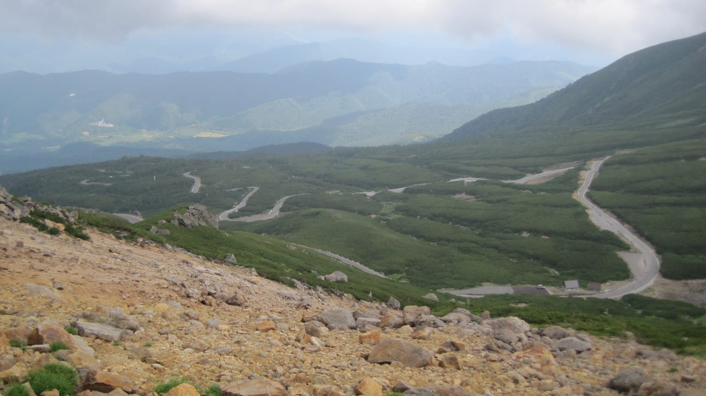
When can you ride Norikura, Shibu Pass and the Japan Alps Cycling Road?
Norikura's car-free road opens to bikes from 1 July to 31 October. Shibu Pass runs from late April to mid November, and the 800 km loop round Nagano breaks into station-to-station days.
Guide · 11 min read
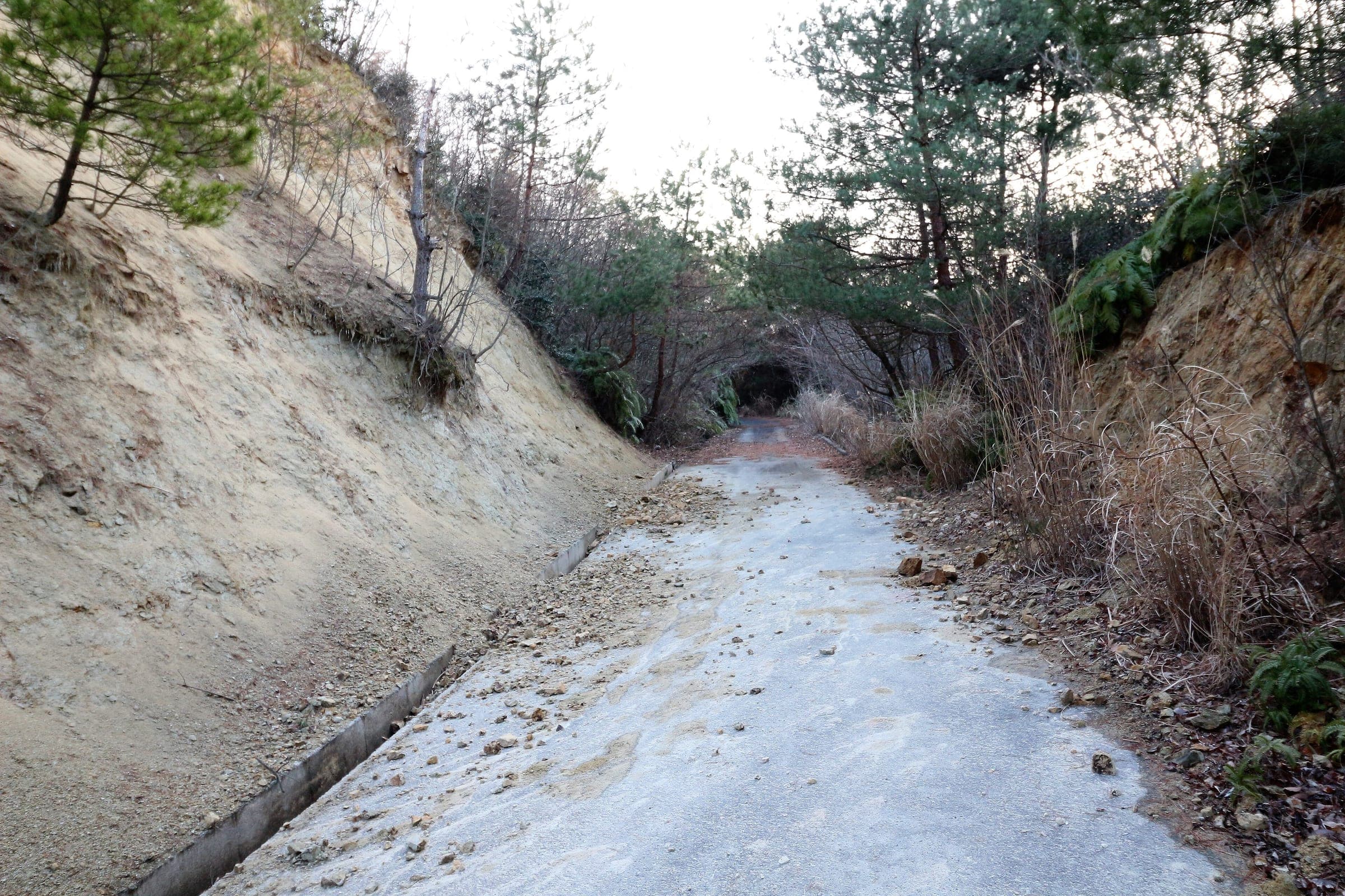
How do you stay safe on a cycling trip in Japan?
Heat sends far more people to hospital than anything with teeth, so the heatstroke alert is the first thing to read on a summer morning. After that come hornets and bears on forest roads, dark tunnels, typhoons from August, and what to do when the ground shakes near the sea.