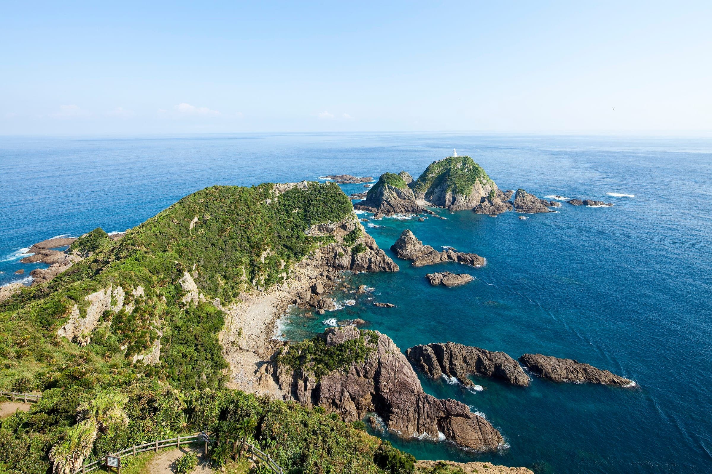
Tsukuba-Kasumigaura Ring-Ring Road
つくば霞ヶ浦りんりんロード36°22′ N 140°06′ E164.4 km · 53 m up · 99% quiet roadsHardRoad bike, Touring
The Tsukuba-Kasumigaura Ring-Ring Road suits riders who want a car-free start on an old railway line under Mt. Tsukuba before a long lap of Lake Kasumigaura, and the trade-off comes on the lake section, where the route joins ordinary roads and the embankments have no guard rails.
Photo NJM4580 · Wikimedia Commons · CC BY-SA 4.0 and others, credited in the gallery
HardPoint to pointRoad bike, Touring, E-bike, City bike
KonbiniDrinking waterToiletsBike shopsTop of chart 100 m
Routed over OpenStreetMap with BRouter trekking and measured against Copernicus DEM GLO-30 30 m on 2026-10-12. The waypoints run counter-clockwise. 5.2 km crosses bridges or water, where the elevation is drawn straight across. 0.3 km runs through tunnels, drawn straight through the hill.
On the road
- Surface
- Sealed. The Iwase to Tsuchiura section runs on the bed of the old Tsukuba Railway, and the lake section follows lakeshore roads and embankments.
- Traffic
- Cars stay off the old railway path. Round Lake Kasumigaura the route also uses national, prefectural and city roads, and Ibaraki asks riders to watch for cars there.
- Start
- JR Iwase Station. The old Tsukuba Railway path starts by the station in Sakuragawa.
- Finish
- JR Tsuchiura Station. Rinrin Square Tsuchiura beside the station is the route's main base, and the lake loop starts and ends nearby.
- Getting there
- Takkyubin for boards and bikes
- In typhoons
- Ibaraki posts typhoon warnings for the route on its cycling site, as it did in August and September 2026. Check the notices there before riding in late summer.
Ride safely
- The embankments round Lake Kasumigaura, on both Nishiura and Kitaura, have no guard rails or other barriers at the water's edge. Keep clear of the edge.
- Away from the old railway path the route shares national, prefectural and city roads with cars.
- Ibaraki asks riders to use the bicycle crossing lane at junctions where there is one, and to get off and push where riding would block people on foot.
Every stop OpenStreetMap lists along the line (30): drinking water, konbini, bike shops, bike rental, cafés
- Drinking waterDrinking waterkm 0
- Drinking waterDrinking waterkm 9.9
- 7-ElevenKonbinikm 17.7
- レンタル自転車(有料)Bike shopskm 20
- Drinking waterDrinking waterkm 20.1
- LawsonKonbinikm 21.9
- 松崎輪店Bike shopskm 24.3
- Drinking waterDrinking waterkm 32.6
- いつくしの杜土浦真鍋Bike rentalkm 38.7
- LawsonKonbinikm 39.3
- HELLO CYCLINGBike rentalkm 39.3
- Bike rentalBike rentalkm 40
- FamilyMartKonbinikm 40.6
- 土浦駅東口前Bike rentalkm 40.7
- LawsonKonbinikm 40.8
- 7-ElevenKonbinikm 41
- Drinking waterDrinking waterkm 57.1
- 美浦村週末カフェCaféskm 65.9
- 7-ElevenKonbinikm 71.2
- Seven-ElevenKonbinikm 90.3
- Drinking waterDrinking waterkm 95.8
- Seven-ElevenKonbinikm 96.7
- 行方市観光物産館こいこいKonbinikm 110.5
- Drinking waterDrinking waterkm 120.7
- FamilyMartKonbinikm 126.6
- Drinking waterDrinking waterkm 127.7
- Bike rentalBike rentalkm 145.7
- Bike rentalBike rentalkm 163.4
- FamilyMartKonbinikm 164.2
- テクノロジーカフェシンギュラリティCaféskm 164.4
From OpenStreetMap, within each kind’s reach of the line. Opening hours change; check before you rely on one.
Ways off the route
IwaseRail
JR Mito Line, at the start of the railway path.
TsuchiuraRail
JR Joban Line, beside Rinrin Square Tsuchiura.
TakahamaRail
JR Joban Line, near the north arm of the lake by Ishioka.
ItakoRail
JR Kashima Line, near the southeast corner of the lake.
IwaseStation · km 0
MiyawakiStation · km 20.4 · 1.9 km off the line
TsuchiuraStation · km 40.8 · 163 m off the line
TakahamaStation · km 127.4 · 583 m off the line
Stations from OpenStreetMap within 2 km of the line. Check whether the line takes bikes before you plan to use it.
Tunnels
The line runs through 6 tunnels, 0.3 km in all; the longest is 100 m.
The route begins at JR Iwase Station and follows the bed of the old Tsukuba Railway south to Tsuchiura. Cars stay off this stretch, and the old station buildings along it now serve as rest stops. Ibaraki pitches it as the part beginners will enjoy most, and a hill-climb course up Mt. Tsukuba branches off it for riders who want to go up.
At Tsuchiura the route meets Lake Kasumigaura and runs right round it on the lakeshore road. On a clear day you look across the water to Mt. Tsukuba and the Ushiku Daibutsu, and lotus fields and rice paddies run along much of the shore.
Rinrin Square Tsuchiura at JR Tsuchiura Station serves as the route's main base. The lake section passes Kasumigaura's water villages inside Suigo-Tsukuba Quasi-National Park, and Kashima Jingu shrine lies within reach to the east.
Worth knowing
- Ride the railway path first and keep the lake for the next day if you want an easy opener.
- Ibaraki's 'Cyclist-Friendly Inns' list helps you find somewhere that will take the bike in for the night.
Quick answers about Tsukuba-Kasumigaura Ring-Ring Roadよくある質問
Is the Tsukuba-Kasumigaura Ring-Ring Road car-free?
Only in part. The old Tsukuba Railway section from Iwase to Tsuchiura keeps cars off, and round Lake Kasumigaura the route also uses ordinary roads.
Where do you start the Ring-Ring Road?
JR Iwase Station is the start of the railway path, and JR Tsuchiura Station beside Rinrin Square Tsuchiura is the base for the Lake Kasumigaura loop. Both stations sit on the official route.
Is the Ring-Ring Road good for beginners?
The railway path is. Ibaraki says the car-free stretch past Mt. Tsukuba suits beginners, and it warns that the lake embankments have no guard rails.
How long is the Tsukuba-Kasumigaura Ring-Ring Road ride?
The Tsukuba-Kasumigaura Ring-Ring Road ride is 164.4 km with 53 m of climbing by our route data, routed over OpenStreetMap and measured against Copernicus DEM GLO-30 30 m. The highest point is 62 m, and the steepest 200 m averages 4.7%.
Where can you buy food and water on the Tsukuba-Kasumigaura Ring-Ring Road ride?
OpenStreetMap lists konbini at 11 points within reach of the Tsukuba-Kasumigaura Ring-Ring Road line, and drinking water at 8. The longest stretch without konbini is 37.6 km, so carry what you need for it.
How busy are the roads on the Tsukuba-Kasumigaura Ring-Ring Road ride?
By road class in OpenStreetMap, 99% of the Tsukuba-Kasumigaura Ring-Ring Road ride runs on quiet roads or paths and 0% on trunk or primary roads.
In the journal and guides