Pacific Cycling Road Stage 4 from Shiomizaka to Cape Irago
太平洋岸自転車道 愛知県区間(潮見坂〜伊良湖岬)34°41′ N 137°29′ E47.9 km · 273 m up · 25% quiet roadsEasyRoad bike, Touring
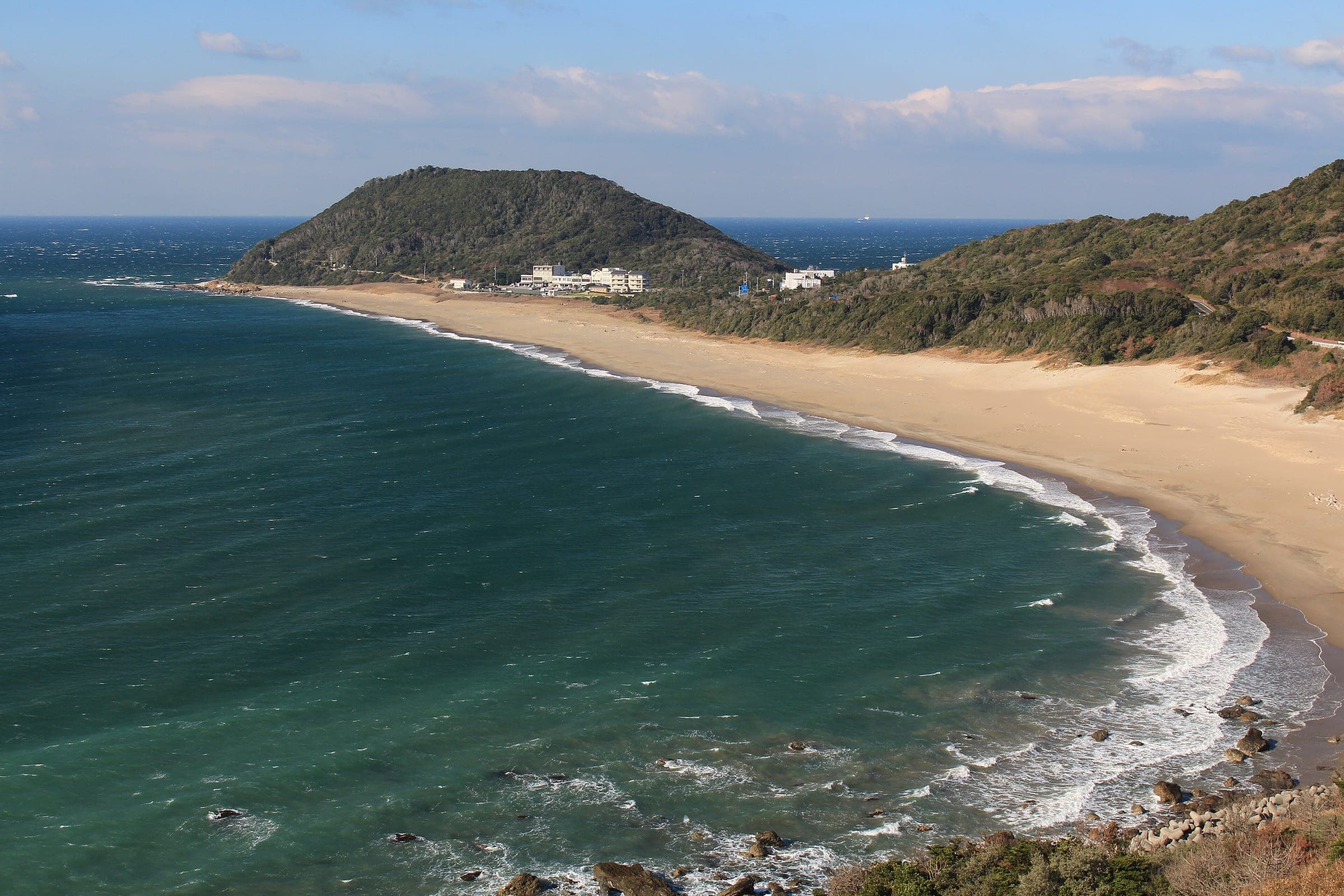
Stage 4 of the Pacific Cycling Road follows the Pacific shore of the Atsumi Peninsula from the Shizuoka border at Shiomizaka to the ferry at Cape Irago, and it suits anyone who wants an easy coastal day between two bigger stages. The open shore gives the wind a free run, and JMA's normals put Irago's winter wind in the north-north-west.
Photo Bariston · Wikimedia Commons · CC BY-SA 4.0 and others, credited in the gallery
EasyStageRoad bike, Touring, E-bike
KonbiniDrinking waterToiletsBike shopsTop of chart 100 m
Routed over OpenStreetMap with BRouter trekking and measured against Copernicus DEM GLO-30 30 m on 2026-10-12. 0.6 km crosses bridges or water, where the elevation is drawn straight across. 0.2 km runs through tunnels, drawn straight through the hill.
On the road
- Wind
- JMA's 1991–2020 normals give Irago a prevailing north-north-west wind in December and January, averaging 4.6 m/s in January, which crosses the shore road from the land side.
- Start
- Shizuoka–Aichi border at Shiomizaka. Michi-no-Eki Shiomizaka sits just over the border in Kosai, and the council's Aichi overview calls this the Shiomizaka to Cape Irago route.
- Finish
- Irago port (Ise-wan Ferry). The Irago terminal is a council gateway with a cycle station, and the Ise-wan Ferry leaves here for Toba, where Stage 5 begins.
- Getting there
- Ise-wan Ferry, Atsumi Line cycle train
- In winter
- JMA's 1991–2020 normals give Irago a January mean of 6.0 °C, with a prevailing north-north-west wind averaging 4.6 m/s.
- In spring
- Rape-blossom fields cover the Atsumi Peninsula in spring, and the council names them as the season's draw.
- In summer
- August highs average 31.6 °C at Irago by JMA's normals. Ride early and carry water.
- In typhoon
- Typhoons reach this coast in late summer and autumn. Check JMA's warnings and the Ise-wan Ferry's notices before you commit to the crossing.
Ride safely
- The council's repair list for Aichi names five shops, all in Tahara City, so carry a spare tube and tools.
- The council's map sets out the rules for the whole route: keep to the left of the carriageway, never ride two abreast, switch lights on at night and in every tunnel, and wear a helmet.
- The council's map warns that bikes go missing from racks at stops along the route, so lock yours even for a quick coffee.
Wind at Hikone, 1991-2020 normals
Which way to ride, month by month風
Jan
NW 3.7
–
Feb
NW 4
–
Mar
NW 3.3
–
Apr
NW 2.8
–
May
NW 2.5
–
Jun
NW 2.4
–
Jul
NW 2.5
–
Aug
NW 2.5
–
Sep
NW 2.9
–
Oct
NW 3.1
–
Nov
NW 2.9
–
Dec
SSE 3.7
–
Arrows point the way the wind blows. Speeds are monthly means in m/s. The wind on any day can differ from the monthly pattern, so check the forecast.
Every stop OpenStreetMap lists along the line (8): konbini
- FamilyMartKonbinikm 2.1
- セブンイレブンKonbinikm 9.6
- FamilyMartKonbinikm 14.6
- LawsonKonbinikm 22.8
- FAMILY MARTKonbinikm 27.2
- FamilyMartKonbinikm 28.1
- LAWSONKonbinikm 28.7
- Circle KKonbinikm 39.4
From OpenStreetMap, within each kind’s reach of the line. Opening hours change; check before you rely on one.
Ways off the route
Mikawa-TaharaRail
Toyohashi Railway Atsumi Line terminus, inland of the shore. Bikes ride on board for a fee with no booking.
Ise-wan Ferry from Irago to TobaFerry
About 55 minutes across the mouth of Ise Bay. Bikes pay a handling fee and need no booking.
Tunnels
The line runs through 3 tunnels, 0.2 km in all; the longest is 125 m.
Most of this stage follows Aichi Prefectural Cycleway 497, which Aichi built along the peninsula's Pacific shore between Toyohashi and Irago. Michi-no-Eki Toyohashi, inland of the shore, is Aichi's gateway and rents e-bikes.
Toward the tip the council picks out the Hiizuru stone gate, where the sunrise shows through an arch in the rock, and Koijigahama beach, the setting of the poem Yashi no Mi about a coconut washed ashore. Irago lighthouse stands at the cape, and the council notes the rape-blossom fields that cover the peninsula in spring.
Toyohashi Railway's Atsumi Line takes bikes on board for a small fee between Shin-Toyohashi and Mikawa-Tahara with no booking. The Ise-wan Ferry from Irago to Toba takes bikes without a booking too, so this stage links easily with the Mie coast.
Worth knowing
- Rent an e-bike at Michi-no-Eki Toyohashi, Michi-no-Eki Tahara Mekkun House or Michi-no-Eki Akabane Roco Station, which the council lists for electric bike hire.
- Stay at the cape and catch the sunrise at the Hiizuru stone gate before the first ferry.
Quick answers about Pacific Cycling Road Stage 4 from Shiomizaka to Cape Iragoよくある質問
How do you get from Irago to Toba with a bike?
Take the Ise-wan Ferry from Irago port to Toba, which takes about 55 minutes on the council's map. Bikes pay a handling fee and need no booking, and a bike in a rinko bag rides on a passenger ticket.
Is the Pacific Cycling Road on the Atsumi Peninsula flat?
Yes, for the most part. The line follows the prefectural cycleway along the Omotehama shore, the Pacific side of the Atsumi Peninsula, to Cape Irago.
How long is the Pacific Cycling Road Stage 4 from Shiomizaka to Cape Irago ride?
The Pacific Cycling Road Stage 4 from Shiomizaka to Cape Irago ride is 47.9 km with 273 m of climbing by our route data, routed over OpenStreetMap and measured against Copernicus DEM GLO-30 30 m. The highest point is 77 m, and the steepest 200 m averages 8.9%.
Where can you buy food and water on the Pacific Cycling Road Stage 4 from Shiomizaka to Cape Irago ride?
OpenStreetMap lists konbini at 8 points within reach of the Pacific Cycling Road Stage 4 from Shiomizaka to Cape Irago line, and drinking water at none. The longest stretch without konbini is 10.7 km, so carry what you need for it.
Which way should you ride Pacific Cycling Road Stage 4 from Shiomizaka to Cape Irago in April to May and October to November?
In April to May and October to November the most frequent wind at the nearest weather station blows from the north-west at about 2.8 m/s on average. By our calculation the Pacific Cycling Road Stage 4 from Shiomizaka to Cape Irago ride finishes with less headwind either way.
Within 8 km