Norikura Echo Line from Sanbondaki
乗鞍エコーライン(三本滝〜畳平)36°07′ N 137°36′ E13.9 km · 899 m up · 1% quiet roadsHardRoad bike, E-road bikeSeasonal
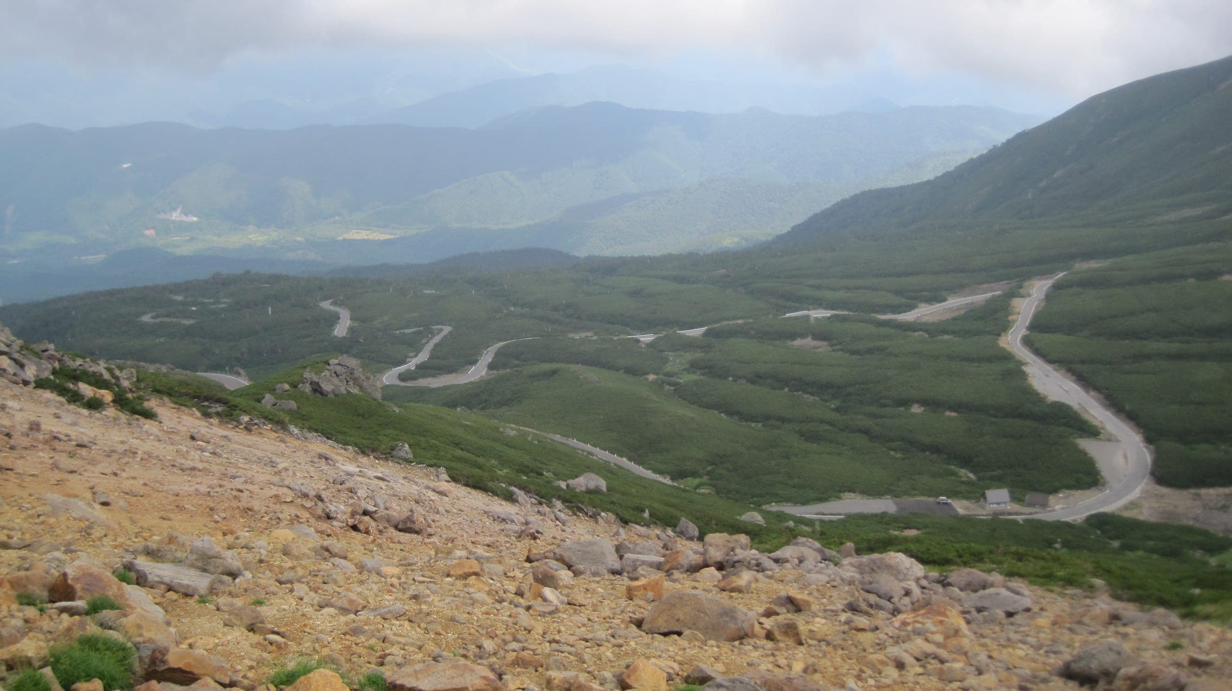
The Norikura Echo Line from Sanbondaki climbs a car-free road to the Tatamidaira bus terminal on the Gifu border, and it suits fit riders who want a high mountain climb shared only with buses and taxis; the trade-off is a short season, from July to October.
Photo Koda6029 · Wikimedia Commons · CC BY-SA 4.0 and others, credited in the gallery
HardPass ascentRoad bike, E-road bike
KonbiniDrinking waterToiletsBike shopsTop of chart 2750 m
Routed over OpenStreetMap with BRouter trekking and measured against Copernicus DEM GLO-30 30 m on 2026-10-12. 0.2 km crosses bridges or water, where the elevation is drawn straight across.
On the road
- Start
- Sanbondaki gate. Private cars stop at this gate on Nagano Prefectural Route 84; Norikura Kogen below has free car parks, and the shuttle buses leave from there.
- Finish
- Tatamidaira (Norikura Tsurugaike car park). This is the summit bus terminal just over the Gifu border, where the Echo Line meets the Norikura Skyline.
- In summer
- Bicycles may ride the Echo Line from 1 July to 31 October. Buses and taxis share it, and private cars are banned all season.
- In autumn
- From 12 September to 12 October 2026 nobody may stop or park between Kuraigahara Sanso and the border gate.
- In winter
- Nagano closes the road above Sanbondaki from 1 November, and the 2026 season's last day is 31 October. Snow clearing ends in late April.
- In spring
- From 27 April to 30 June 2026 only the spring route bus and permit holders could use the road, so bikes wait for July.
Ride safely
- Asian black bears live in the forests along this road. The Ministry of the Environment posts national sightings and advice, so read it before an early-morning or late-season ride.
- Mt. Norikura is an active volcano. JMA keeps it at alert level 1 and posts any change on its Norikura page: https://www.data.jma.go.jp/vois/data/report/activity_info/311.html
- Heavy rain closes the road, and the 2026 Norikura Hill Climb was called off on race morning for that reason. Check the road status before you set out.
Wind at Takayama, 1991-2020 normals
Which way to ride, month by month風
Jan
NNW 1.3
–
Feb
NNW 1.5
–
Mar
NNW 1.9
–
Apr
NNW 2.1
–
May
NNW 2
–
Jun
NNW 1.8
–
Jul
NNW 1.9
–
Aug
N 1.8
–
Sep
NNW 1.6
–
Oct
NNW 1.5
–
Nov
NNW 1.4
–
Dec
NNW 1.4
–
Arrows point the way the wind blows. Speeds are monthly means in m/s. The wind on any day can differ from the monthly pattern, so check the forecast.
Where to stop
Stops along the way寄り道
Prefectural border gateView
The gate marks the top of the Nagano side, just below Tatamidaira.
Ways off the route
TatamidairaBus
Shuttle buses run between the summit and Norikura Kogen; ask about bikes before you rely on one.
Nagano's Norikura Echo Line climbs from the Norikura Kogen plateau to the summit car park at Tatamidaira, and above the Sanbondaki gate the prefecture keeps private cars off to protect the mountain. From July to October that leaves the road to bikes and the buses.
The Norikura Hill Climb races up the same road each August from lower down the plateau. In autumn Nagano bans stopping and parking between Kuraigahara Sanso and the border gate, so plan your photo stops at the car parks.
Nagano opens the road to the spring bus in late April, when snow walls still line the upper section, and riders get it from 1 July. The prefecture shuts it above Sanbondaki on 1 November, and early snow can close it sooner.
Worth knowing
- Take a warm layer and a jacket for the top at Tatamidaira.
- Leave the car at Norikura Kogen's free car parks and ride up to the Sanbondaki gate to start.
Quick answers about Norikura Echo Line from Sanbondakiよくある質問
Can you cycle the Norikura Echo Line?
Yes, from 1 July to 31 October. Nagano bans private cars on the Norikura Echo Line above the Sanbondaki gate all season, and from July bicycles may ride it alongside the buses.
When does the Norikura Echo Line close for winter?
On 1 November. Nagano shuts the Norikura Echo Line above Sanbondaki for the winter, and the last day for bikes in 2026 is 31 October.
How long is the Norikura Echo Line from Sanbondaki ride?
The Norikura Echo Line from Sanbondaki ride is 13.9 km with 899 m of climbing by our route data, routed over OpenStreetMap and measured against Copernicus DEM GLO-30 30 m. The highest point is 2,715 m, and the steepest 200 m averages 11.7%.
Where can you buy food and water on the Norikura Echo Line from Sanbondaki ride?
OpenStreetMap lists konbini at no point within reach of the Norikura Echo Line from Sanbondaki line, and drinking water at none. The longest stretch without konbini is 13.9 km, so carry what you need for it.
Is Norikura Echo Line from Sanbondaki open all year?
Norikura Echo Line from Sanbondaki opens for part of the year. Open to bicycles until 31 October 2026, then closed above Sanbondaki for the winter.
In the journal and guides
Read more about Norikura Echo Line from Sanbondaki特集
Feature · 9 min read
When can you ride Norikura, Shibu Pass and the Japan Alps Cycling Road?
Norikura's car-free road opens to bikes from 1 July to 31 October. Shibu Pass runs from late April to mid November, and the 800 km loop round Nagano breaks into station-to-station days.
Guide · 11 min read
How do you stay safe on a cycling trip in Japan?
Heat sends far more people to hospital than anything with teeth, so the heatstroke alert is the first thing to read on a summer morning. After that come hornets and bears on forest roads, dark tunnels, typhoons from August, and what to do when the ground shakes near the sea.