Yukiguni Uonuma Golden Cycle Route
雪国魚沼Golden Cycle Route37°10′ N 138°56′ E199.7 km · 1,582 m up · 54% quiet roadsEpicRoad bike, E-road bike
The Yukiguni Uonuma Golden Cycle Route suits riders who want quiet roads through the rice country of Uonuma under the Echigo mountains, with a dam hill climb thrown in, and the trade-off is the snow, since some roads on the route close for the winter in one of Japan's snowiest districts.
Photo Tariqsheikh · Wikimedia Commons · CC BY-SA 4.0 and others, credited in the gallery
EpicLoopRoad bike, E-road bike, E-bike, Touring
KonbiniDrinking waterToiletsBike shopsTop of chart 600 m
Routed over OpenStreetMap with BRouter trekking and measured against Copernicus DEM GLO-30 30 m on 2026-10-12. The waypoints run clockwise. 6.6 km crosses bridges or water, where the elevation is drawn straight across. 2.3 km runs through tunnels, drawn straight through the hill.
On the road
- Surface
- Sealed. MLIT's review found no unpaved sections, and it notes mud on farm roads and fallen leaves in the hills in spring.
- Traffic
- The official site describes the North Uonuma stage as low in traffic. The route links village and farm roads across the Uonuma basin.
- Start
- JR Urasa Station. Urasa Station on the Joetsu Shinkansen is the route's gateway, with rental bikes and route maps. Both of the big loops pass close by.
- Getting there
- Joetsu Shinkansen, Oversized baggage on the Shinkansen
- In winter
- The route crosses one of Japan's heaviest snowfall areas, and some roads on it close for the winter. Road managers sweep them before they reopen in spring.
- In autumn
- Before the harvest the Koshihikari rice turns the Uonuma valley gold, which gives the route its name.
Ride safely
- MLIT's review counted 16 narrow tunnels on the route. The council expects the warning signs for them to be finished during fiscal 2026.
- Sweep crews clear the winter-closed roads before they open in spring, and MLIT's review still asks for work on farm mud and fallen leaves, so ride the first spring weeks with care.
- The Sagurigawa Dam course is a serious hill climb used in road races, and the road round the reservoir rises and falls steeply.
Wind at Yuzawa, 1991-2020 normals
Which way to ride, month by month風
Jan
NW 1.6
Either way
Feb
NW 1.8
Either way
Mar
SE 1.8
Either way
Apr
SE 2
Either way
May
SE 2
Either way
Jun
NW 1.8
Either way
Jul
NW 1.6
Either way
Aug
SE 1.7
Either way
Sep
SE 1.7
Either way
Oct
SE 1.6
Either way
Nov
SE 1.6
Either way
Dec
SE 1.5
Either way
Arrows point the way the wind blows. Speeds are monthly means in m/s. The wind on any day can differ from the monthly pattern, so check the forecast.
Where to stop
Stops along the way寄り道
MinamiuonumaTown
Sakado Castle ruins park and the Bokushi-dori street both sit on the southern loop.
YuzawaTown
The southern loop reaches the onsen town of Echigo-Yuzawa.
Every stop OpenStreetMap lists along the line (18): konbini, cafés, bike shops
- 7-ElevenKonbinikm 0
- セブンイレブンKonbinikm 11.7
- Seven-ElevenKonbinikm 14.4
- ローソンKonbinikm 16.4
- LawsonKonbinikm 20.9
- 7-ElevenKonbinikm 22.1
- ローソンKonbinikm 60.4
- ウッデイCaféskm 61.2
- セブンイレブンKonbinikm 65.9
- 7-ElevenKonbinikm 74.3
- FamilyMartKonbinikm 87.5
- Yamazaki ShopKonbinikm 115.1
- 7-ElevenKonbinikm 120.3
- Bicycle shopBike shopskm 123.2
- LawsonKonbinikm 147.4
- 7-ElevenKonbinikm 185.6
- 7-ElevenKonbinikm 191
- 7-ElevenKonbinikm 199.7
From OpenStreetMap, within each kind’s reach of the line. Opening hours change; check before you rely on one.
Ways off the route
UrasaRail
JR Joetsu Line and the Joetsu Shinkansen.
KoideRail
JR Joetsu Line and the Tadami Line, on the northern loop.
MuikamachiRail
JR Joetsu Line.
ShiozawaRail
JR Joetsu Line, by the Bokushi-dori street.
Echigo-YuzawaRail
JR Joetsu Line and the Joetsu Shinkansen, at the southern end of the route.
YairoStation · km 9.4 · 1.1 km off the line
KoideStation · km 15.4 · 309 m off the line
Echigo-HiroseStation · km 21.4
Uonuma-TanakaStation · km 24.3 · 196 m off the line
Echigo-SuharaStation · km 28.9 · 161 m off the line
KamijōStation · km 34.4
IrihiroseStation · km 39.1
YabukamiStation · km 56 · 498 m off the line
MuikamachiStation · km 123.2 · 599 m off the line
Iwappara-Ski-jo-maeStation · km 147.5 · 240 m off the line
Echigo-NakazatoStation · km 149.9 · 199 m off the line
Echigo-YuzawaStation · km 165.2 · 310 m off the line
Gala-YuzawaStation · km 167.1 · 222 m off the line
IshiuchiStation · km 171.7
OsawaStation · km 176.7
Joetsu-Kokusai-Ski-jo-maeStation · km 177.9
ShiozawaStation · km 180.3
Uonuma-KyuryoStation · km 189.2
ItsukamachiStation · km 194
UrasaStation · km 199.7 · 212 m off the line
Stations from OpenStreetMap within 2 km of the line. Check whether the line takes bikes before you plan to use it.
Tunnels
The line runs through 16 tunnels, 2.3 km in all; the longest is 350 m.
Rental near the start
Rent a bike for itレンタル
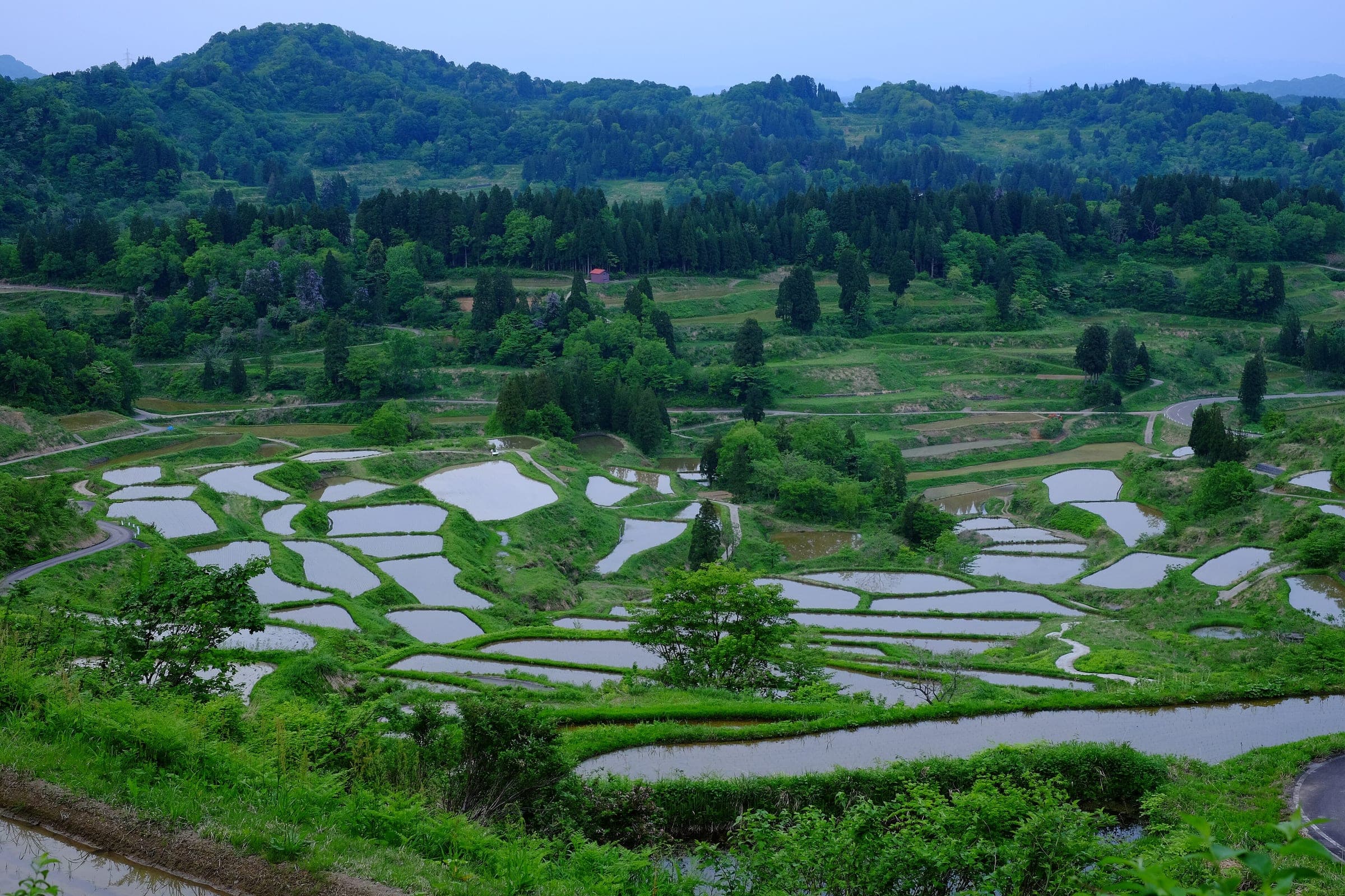
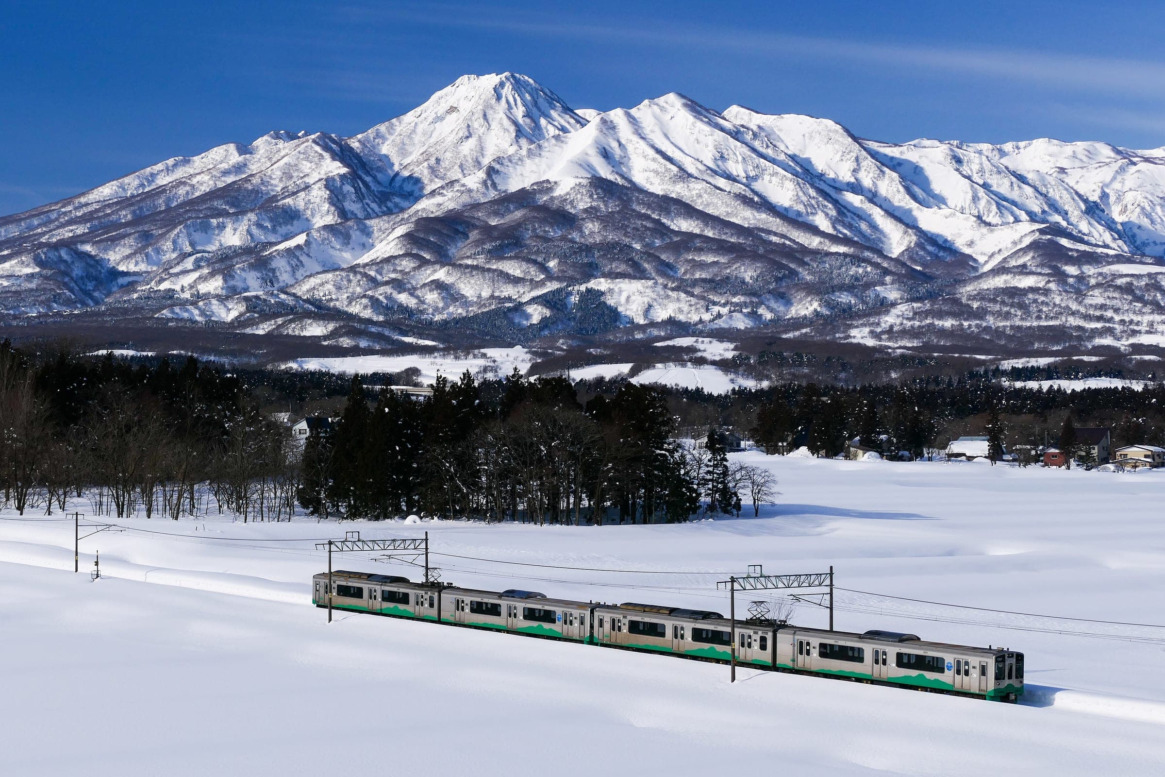
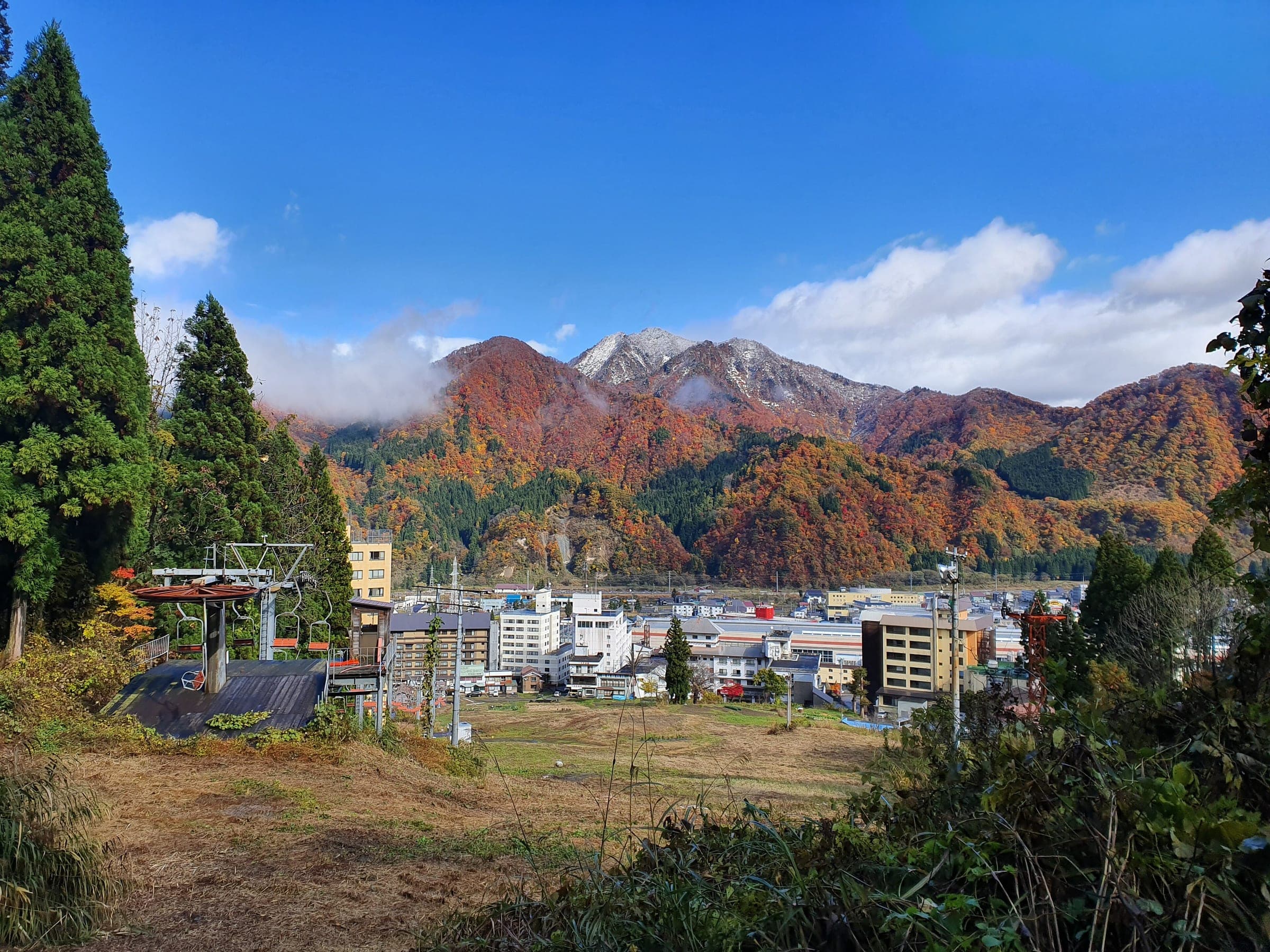
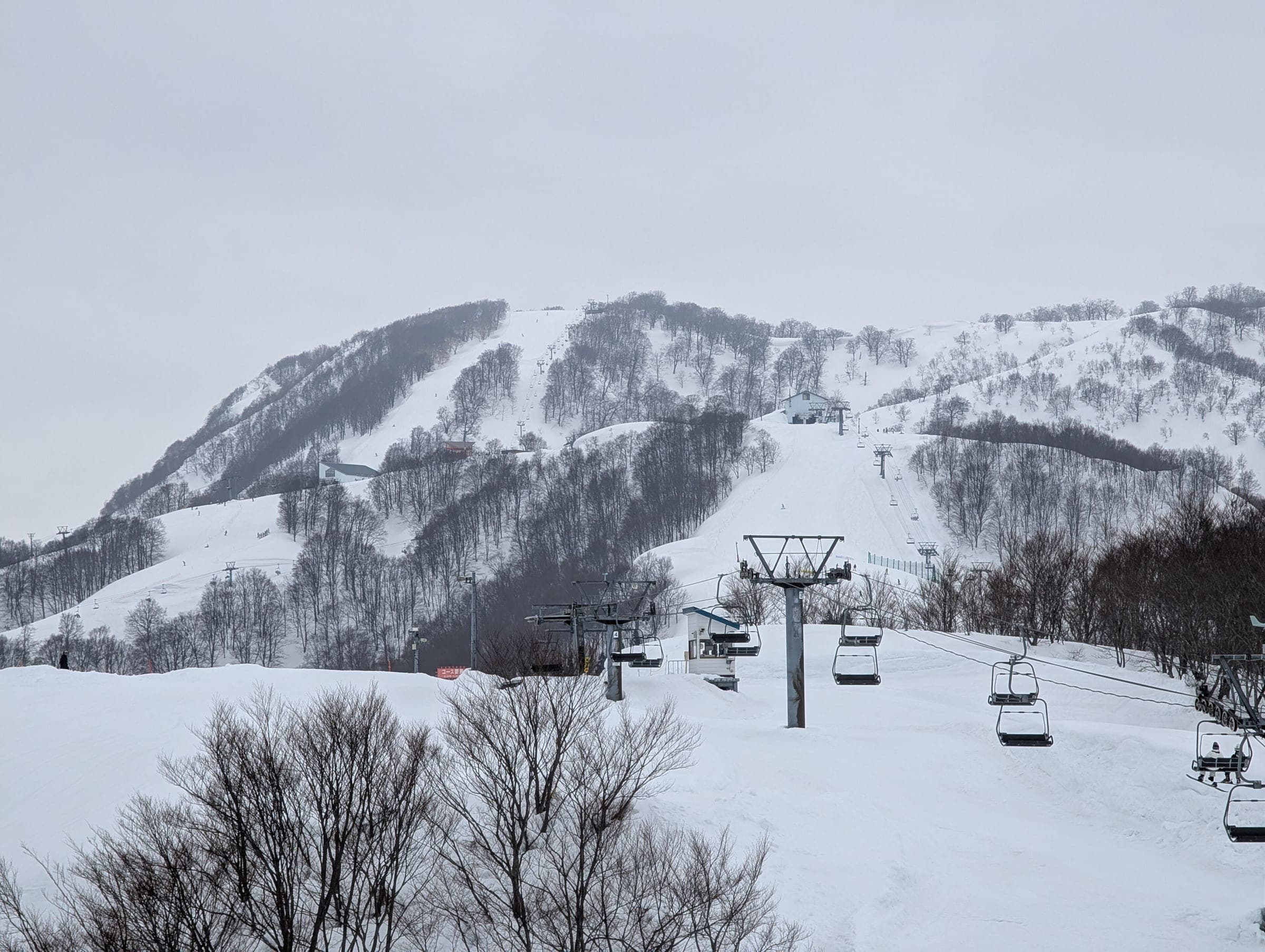
Yuzawa, Minamiuonuma and Uonuma set the route up together in August 2021 as Niigata's first model cycle-tourism route. This page rides it as one figure from JR Urasa Station, taking the northern loop through Uonuma first and then the southern loop through Minamiuonuma and Yuzawa with the dam climb folded in.
The North Uonuma stage follows the Tadami Line up into mountain villages. The official site calls it easy going for beginners in spite of the height you gain, because traffic stays light, and it passes the Meguro residence, which the state lists as an Important Cultural Property, and Michi-no-Eki Yunotani for local food.
The South Uonuma stage crosses open paddy country with the Echigo range behind it. Uesugi Kagekatsu and Naoe Kanetsugu grew up at Sakado Castle, and a park now covers the ruins. Further south you ride down Bokushi-dori, an old post-town street, before the loop reaches the hot-spring town of Echigo-Yuzawa that Kawabata wrote into Snow Country.
The Sagurigawa Dam course is the hard part. Road races use it, and the official site sends riders there once they have outgrown the beginner label.
Worth knowing
- Ride the route in late summer if you want to see the rice turn gold.
- Split it over two days with a night near Urasa, since both loops start close to the station.
Quick answers about Yukiguni Uonuma Golden Cycle Routeよくある質問
Can you ride the Yukiguni Uonuma Golden Cycle Route in winter?
Not all of it. Some roads on the Golden Cycle Route close for the winter snow, and road managers sweep them before they reopen in spring.
Where does the Golden Cycle Route start?
JR Urasa Station on the Joetsu Shinkansen is the route's gateway, and Echigo-Yuzawa Station is the other main way in.
Why is it called the Golden Cycle Route?
The name comes from the Koshihikari rice that turns the Uonuma valley gold before the harvest, and from the hope that it becomes one of Japan's leading cycling routes.
How long is the Yukiguni Uonuma Golden Cycle Route ride?
The Yukiguni Uonuma Golden Cycle Route ride is 199.7 km with 1,582 m of climbing by our route data, routed over OpenStreetMap and measured against Copernicus DEM GLO-30 30 m. The highest point is 573 m, and the steepest 200 m averages 11.8%.
Where can you buy food and water on the Yukiguni Uonuma Golden Cycle Route ride?
OpenStreetMap lists konbini at 14 points within reach of the Yukiguni Uonuma Golden Cycle Route line, and drinking water at none. The longest stretch without konbini is 38.3 km, so carry what you need for it.
Within 8 km