Tottori Uminami Road
鳥取うみなみロード35°36′ N 134°22′ E151.5 km · 896 m up · 24% quiet roadsHardRoad bike, Touring
The Tottori Uminami Road suits riders who want to cross Tottori Prefecture along the Sea of Japan from Higashihama to Sakaiminato past the Tottori Sand Dunes, and the trade-off is that most of it runs on ordinary roads beside the traffic.
Photo Suicasmo · Wikimedia Commons · CC BY-SA 4.0 and others, credited in the gallery
HardPoint to pointRoad bike, Touring, E-bike
KonbiniDrinking waterToiletsBike shopsTop of chart 150 m
Routed over OpenStreetMap with BRouter trekking and measured against Copernicus DEM GLO-30 30 m on 2026-10-12. 5.4 km crosses bridges or water, where the elevation is drawn straight across. 1.2 km runs through tunnels, drawn straight through the hill.
On the road
- Surface
- Sealed. Apart from a few sections the route runs on ordinary roads, which have carried arrow markings and bicycle pictograms since 2023.
- Traffic
- The route follows National Route 9 for much of its length. Traffic on it has fallen since the San'in Expressway opened, which is why the prefecture chose it.
- Start
- JR Higashihama Station. Tottori publishes the route in both directions. This page rides it westbound from Higashihama on the detour the prefecture posts for the closed Nishiwaki section.
- Finish
- JR Sakaiminato Station. The station stands at the end of Mizuki Shigeru Road.
Ride safely
- A section of town road near the Nishiwaki lookout car park is closed. Use the detour on Prefectural Road 178 to reach Higashihama Station.
- Most of the route shares the road with cars and trucks. Follow the arrow markings and keep left.
- MLIT's review found two narrow tunnels on the route, both with warning signs.
Every stop OpenStreetMap lists along the line (46): konbini, cafés, bike rental
- FamilyMartKonbinikm 11.5
- レイガーデンCaféskm 22.2
- 鳥取砂丘東側(鳥取砂丘駐車場)Bike rentalkm 22.4
- TAKAHAMA CAFÈCaféskm 22.4
- CHOCOLAT さんかく氷Caféskm 22.5
- SUKATTOCaféskm 22.5
- 砂丘珈琲Caféskm 22.8
- 鳥取砂丘西側(ヤマタ鳥取砂丘ステイション)Bike rentalkm 24.5
- LawsonKonbinikm 26.2
- LawsonKonbinikm 29.7
- Re:make cafe&barCaféskm 30.4
- CafésCaféskm 31.8
- すなば珈琲 賀露店Caféskm 33.2
- LawsonKonbinikm 38.4
- FamilyMartKonbinikm 38.8
- sun set cafe Caféskm 39.7
- ほたるかずらCaféskm 51.2
- LawsonKonbinikm 52.8
- CafésCaféskm 53.5
- FamilyMartKonbinikm 55.6
- すなば珈琲Caféskm 60.5
- セブンイレブン 泊東郷インター前店Konbinikm 71.7
- Lawson-PoplarKonbinikm 82
- LawsonKonbinikm 84.2
- LawsonKonbinikm 89.7
- LAWSONKonbinikm 95.4
- POPLARKonbinikm 95.6
- ローソンKonbinikm 96
- LAWSONKonbinikm 98.5
- Lawson PoplarKonbinikm 101.6
- LawsonKonbinikm 104.6
- MaricosanCaféskm 107.7
- LawsonKonbinikm 116.3
- LawsonKonbinikm 116.5
- LawsonKonbinikm 122.6
- オーケーKonbinikm 122.7
- LawsonKonbinikm 126.7
- FamilyMartKonbinikm 134.5
- Komeda's CoffeeCaféskm 143.3
- FamilyMartKonbinikm 143.4
- LawsonKonbinikm 144.8
- LAWSONKonbinikm 146.8
- FamilyMartKonbinikm 147.2
- ポパイCaféskm 150.6
- コーヒータイムA・CCaféskm 150.9
- 大正川カフェCaféskm 151
From OpenStreetMap, within each kind’s reach of the line. Opening hours change; check before you rely on one.
Ways off the route
HigashihamaRail
JR San'in Line, at the eastern end.
IwamiRail
JR San'in Line, for the Uradome coast.
TottoriRail
JR San'in Line.
KurayoshiRail
JR San'in Line, inland of Lake Togo.
YonagoRail
JR San'in Line and the Sakai Line.
SakaiminatoRail
JR Sakai Line, at the western end.
HigashihamaStation · km 0
IwamiStation · km 13.6 · 1.6 km off the line
ŌiwaStation · km 14.7
FukubeStation · km 17.6 · 1.6 km off the line
KoyamaStation · km 35.2 · 1.6 km off the line
Tottoridaigaku-MaeStation · km 35.4 · 616 m off the line
SuetsuneStation · km 39.1 · 327 m off the line
HamamuraStation · km 57.1 · 448 m off the line
AoyaStation · km 64.3 · 433 m off the line
TomariStation · km 70.5
ShimohōjōStation · km 84.7
YuraStation · km 89.8 · 188 m off the line
UrayasuStation · km 95.6 · 454 m off the line
YabaseStation · km 97.3
AkasakiStation · km 101.1 · 517 m off the line
NakayamaguchiStation · km 105.3 · 343 m off the line
ShimoichiStation · km 107.7 · 198 m off the line
MikuriyaStation · km 113.6
NawaStation · km 114.9
DaisenguchiStation · km 119.2 · 966 m off the line
YodoeStation · km 123.5 · 415 m off the line
KawasakiguchiStation · km 137.8 · 1.4 km off the line
YumigahamaStation · km 139.5 · 1.2 km off the line
WadahamaStation · km 141.9 · 1.2 km off the line
ŌshinozuchōStation · km 143.3 · 1.2 km off the line
Yonago AirportStation · km 144.6 · 928 m off the line
NakahamaStation · km 145.3 · 878 m off the line
TakamatsuchōStation · km 146 · 814 m off the line
AmarikoStation · km 146.7 · 863 m off the line
AgarimichiStation · km 147.7 · 1.1 km off the line
JR 西日本旅客鉄道
BabasakichōStation · km 151.5 · 802 m off the line
SakaiminatoStation · km 151.5
Stations from OpenStreetMap within 2 km of the line. Check whether the line takes bikes before you plan to use it.
Tunnels
The line runs through 10 tunnels, 1.1 km in all; the longest is 500 m.
Rental near the start
Rent a bike for itレンタル
Tottori opened the whole route on 22 March 2020 to bring visitors back to the towns along National Route 9 after the San'in Expressway drew the through traffic away. Because it follows that main road for much of the way, the prefecture says riders new to the area can find their way without trouble.
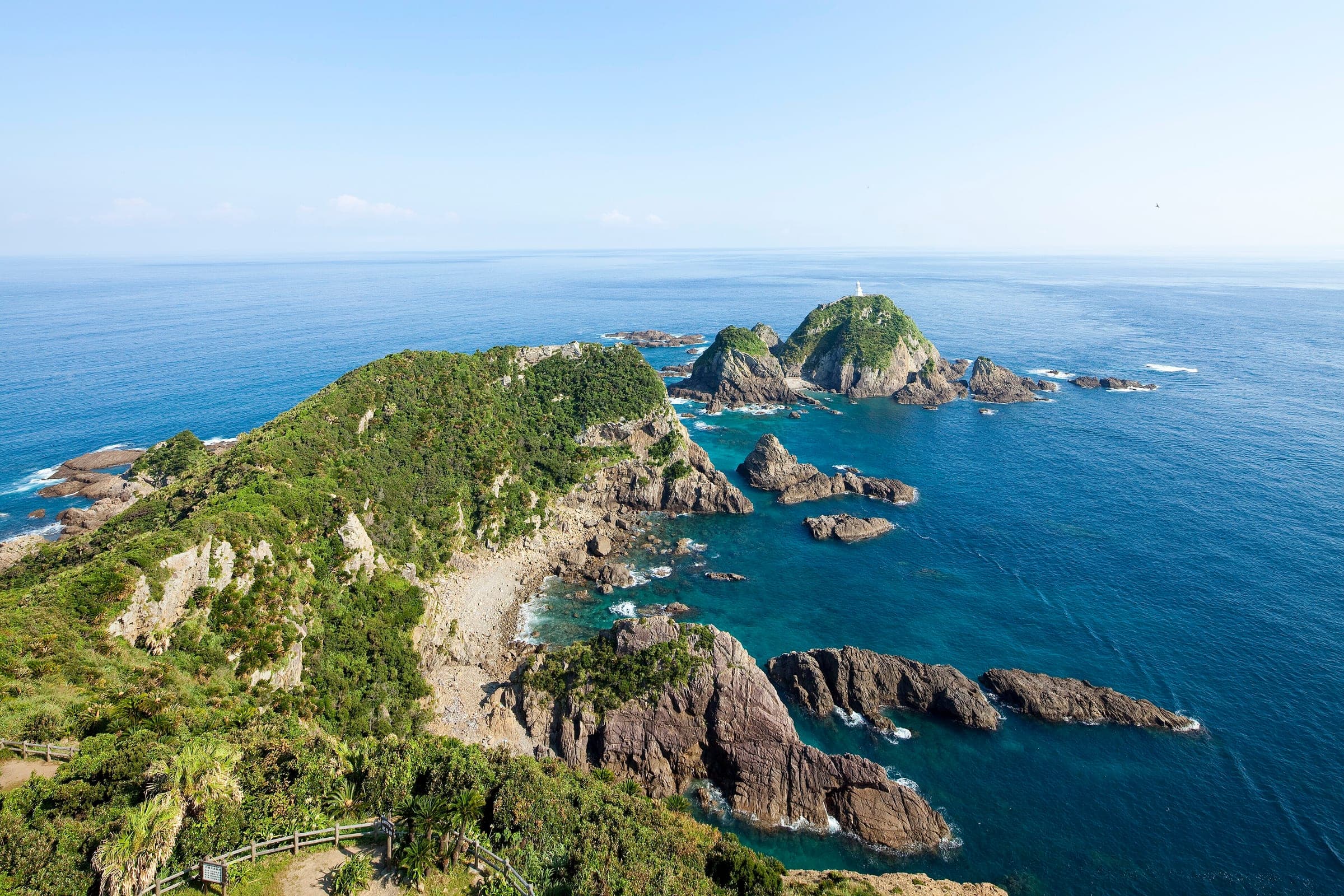
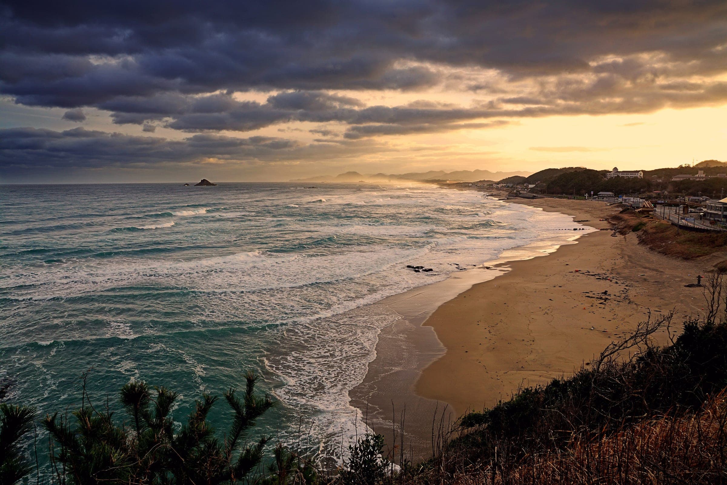
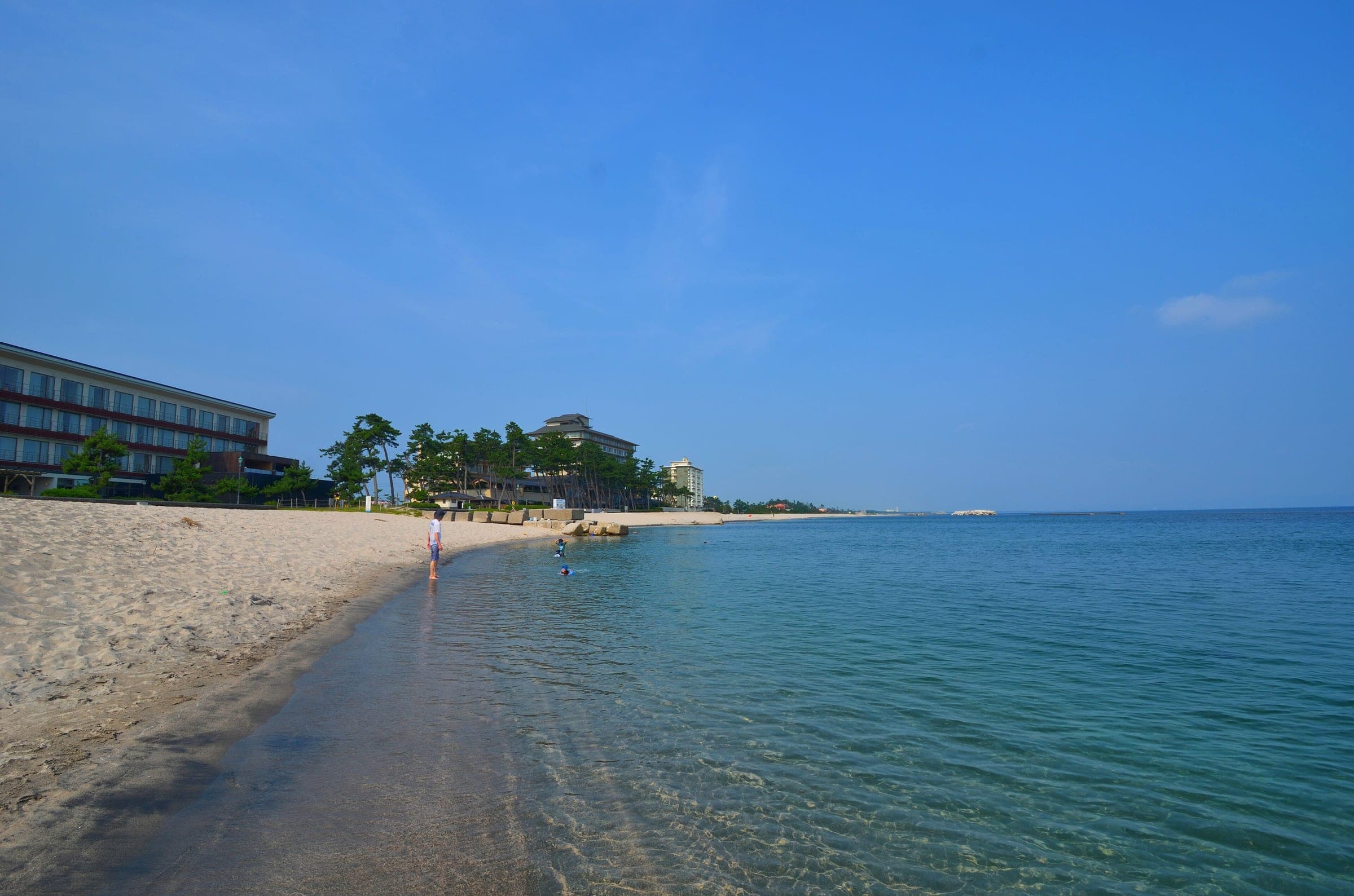
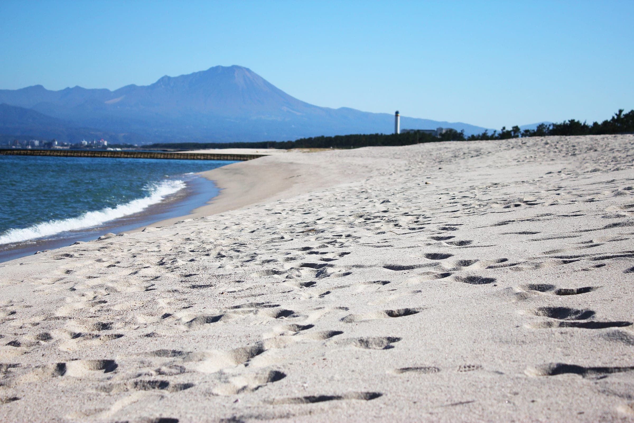
Riding west from Higashihama you pass the Uradome coast and the Tottori Sand Dunes, then the Hakuto shore and Lake Togo. The hot springs at Hawai and Kaike both sit near the line. The last stretch runs down the pine-backed white sand of Yumigahama to Sakaiminato and Mizuki Shigeru Road.
Plan meals round Sea of Japan seafood and Tottori's beef-bone ramen.
Worth knowing
- Tottori posts both directions on Ride with GPS, including the current detour, so load the one you plan to ride.
- Four signed local routes leave the main line, including one round Lake Koyama and one up to the Mukibanda Yayoi-period site.
Quick answers about Tottori Uminami Roadよくある質問
Which way should you ride the Tottori Uminami Road?
Either way. Tottori Prefecture publishes the Tottori Uminami Road in both directions, from JR Higashihama Station to JR Sakaiminato Station and back.
Is the Tottori Uminami Road on cycle paths?
Mostly no. Apart from a few sections it runs on ordinary roads, and the prefecture has been painting arrow markings and bicycle pictograms on them since 2023.
Is any of the Tottori Uminami Road closed?
Yes. Part of the town road near the Nishiwaki lookout car park is closed, and Tottori posts a detour on Prefectural Road 178 to Higashihama Station.
How long is the Tottori Uminami Road ride?
The Tottori Uminami Road ride is 151.5 km with 896 m of climbing by our route data, routed over OpenStreetMap and measured against Copernicus DEM GLO-30 30 m. The highest point is 131 m, and the steepest 200 m averages 11.4%.
Where can you buy food and water on the Tottori Uminami Road ride?
OpenStreetMap lists konbini at 27 points within reach of the Tottori Uminami Road line, and drinking water at none. The longest stretch without konbini is 16.1 km, so carry what you need for it.
In the journal and guides