Akinada Tobishima Kaido
安芸灘とびしま海道34°14′ N 132°41′ E33.7 km · 295 m up · 27% quiet roadsModerateRoad bike, Touring
The Akinada Tobishima Kaido is a day ride from Kure across seven bridges to Okamura island in Ehime, and it suits riders who want old port towns and sea views across the islands; the catch is the far end, where you need a ferry or the same road back.
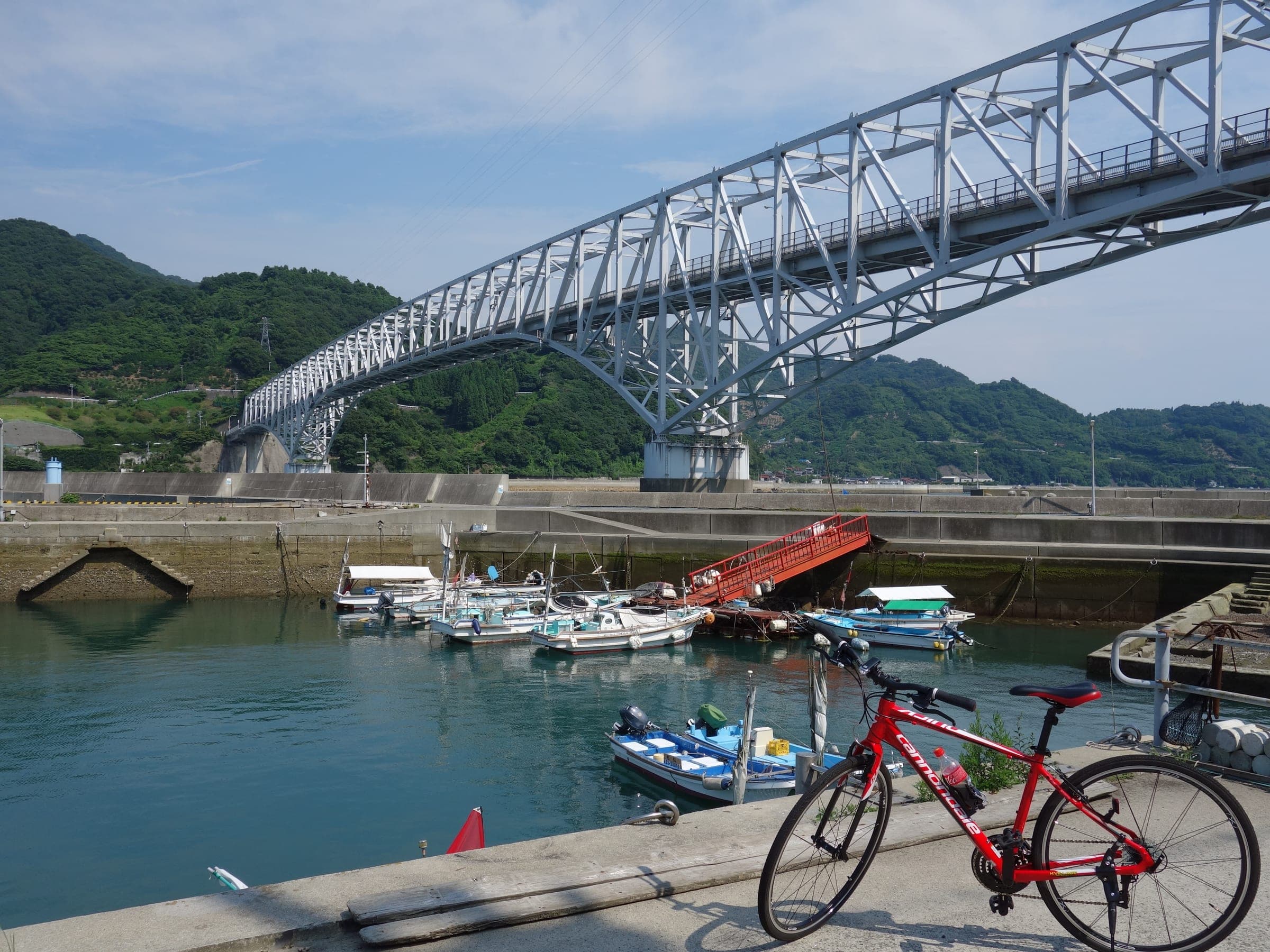
Photo KUNIO MIURA · Wikimedia Commons · CC BY 3.0 and others, credited in the gallery
ModeratePoint to pointRoad bike, Touring, E-bike
KonbiniDrinking waterToiletsBike shopsTop of chart 100 m
Routed over OpenStreetMap with BRouter trekking and measured against Copernicus DEM GLO-30 30 m on 2026-10-12. 5.4 km crosses bridges or water, where the elevation is drawn straight across. 1.2 km runs through tunnels, drawn straight through the hill.
On the road
- Start
- JR Aki-Kawajiri Station. The Kure Line station stands in Kure's Kawajiri district on the mainland, a short ride from the foot of the Akinada Bridge where the cycling road begins.
- Finish
- Okamura Port. Okamura is the last island and belongs to Imabari in Ehime. Imabari's city-run Sekizen ferry sails from the port to Imabari by way of Oge and Kooge, so check with the city whether it takes bikes on your sailing.
Ride safely
- The Hiroshima Prefectural Road Public Corporation asks riders on the Tobishima cycling road to watch for cars and people on foot and to keep to the traffic rules, and it links the Hiroshima police's five rules for riding safely.
- Seven bridges carry the road from island to island, and the Akinada Bridge at the start is a toll road the corporation runs.
Wind at Imabari, 1991-2020 normals
Which way to ride, month by month風
Jan
WSW 1.9
–
Feb
WSW 1.9
–
Mar
ENE 1.9
–
Apr
ENE 1.8
–
May
ENE 1.6
–
Jun
ENE 1.5
–
Jul
WNW 1.6
–
Aug
ENE 1.6
–
Sep
ENE 1.6
–
Oct
ENE 1.8
–
Nov
SSW 1.7
–
Dec
W 1.9
–
Arrows point the way the wind blows. Speeds are monthly means in m/s. The wind on any day can differ from the monthly pattern, so check the forecast.
Where to stop
Stops along the way寄り道
MitaraiSight
Mitarai is the old port on Osaki-shimojima, and the road corporation's map marks its Tenmangu shrine and the Rekishi no Mieru Oka lookout above the harbour.
Every stop OpenStreetMap lists along the line (2): drinking water, konbini
- Drinking waterDrinking waterkm 21.1
- KonbiniKonbinikm 26.5
From OpenStreetMap, within each kind’s reach of the line. Opening hours change; check before you rely on one.
Ways off the route
Aki-KawajiriRail
The JR Kure Line stops here at the mainland start.
Okamura PortFerry
Imabari's Sekizen ferry links Okamura with Imabari; confirm bikes with the city before you rely on it.
Aki-KawajiriStation · km 0
西日本旅客鉄道
Stations from OpenStreetMap within 2 km of the line. Check whether the line takes bikes before you plan to use it.
Tunnels
The line runs through 3 tunnels, 1.2 km in all; the longest is 800 m.
Hiroshima's prefectural road corporation describes the Tobishima Kaido as a chain of seven bridges from Kure across the Akinada islands to Okamura island in Imabari, Ehime. The islands sit in the sea like the stepping stones of a garden, and that picture gave the route its name. Six of the islands are part of Kure. The cycling road begins in Kawajiri at the Akinada Bridge, and that's the one toll bridge on the chain.
Kure city says you can keep to the gentle coast roads or go looking for the climbs the islands throw up. Its cycle stations lend simple tools and stands to passing riders, and two sit right on the way: Umi-eki Sannoseki on Shimo-kamagari and the Mitarai rest house on Osaki-shimojima. The city also points to the beaches and a preserved historic townscape along the way.
Mitarai is the stop to plan the day round. The road corporation's map marks its Tenmangu shrine and a lookout over the old harbour, and the rest house there is one of Kure's cycle stations. From there the road crosses to Okamura, where the line ends at the ferry port.
Worth knowing
- Load the road corporation's Google map of the route before you go; it marks the public toilets and rest stops island by island.
- Start at JR Aki-Kawajiri on the Kure Line, which puts you on the mainland side of the Akinada Bridge without riding through central Kure.
Quick answers about Akinada Tobishima Kaidoよくある質問
Where does the Tobishima Kaido start and finish?
The Tobishima Kaido starts at the Akinada Bridge in Kure's Kawajiri district and finishes on Okamura island in Imabari, Ehime. JR Aki-Kawajiri Station on the Kure Line is the nearest station to the start, and the route ends at Okamura Port.
Is the Tobishima Kaido hilly?
It can be either. Kure city says riders on the Tobishima Kaido can keep to gentle coast roads or take on the climbs the islands offer.
How long is the Akinada Tobishima Kaido ride?
The Akinada Tobishima Kaido ride is 33.7 km with 295 m of climbing by our route data, routed over OpenStreetMap and measured against Copernicus DEM GLO-30 30 m. The highest point is 57 m, and the steepest 200 m averages 9.1%.
Where can you buy food and water on the Akinada Tobishima Kaido ride?
OpenStreetMap lists konbini at one point within reach of the Akinada Tobishima Kaido line, and drinking water at one. The longest stretch without konbini is 26.5 km, so carry what you need for it.
Which way should you ride Akinada Tobishima Kaido in April to May and October to November?
In April to May and October to November the most frequent wind at the nearest weather station blows from the east-north-east at about 1.7 m/s on average. By our calculation the Akinada Tobishima Kaido ride finishes with less headwind either way.
How busy are the roads on the Akinada Tobishima Kaido ride?
By road class in OpenStreetMap, 27% of the Akinada Tobishima Kaido ride runs on quiet roads or paths and 11% on trunk or primary roads.
In the journal