Fukushima Hamadori Cycle Route
ふくしま浜通りサイクルルート36°52′ N 140°47′ E176.3 km · 1,223 m up · 41% quiet roadsHardRoad bike, Touring
The Fukushima Hamadori Cycle Route suits riders who want Fukushima's Pacific coast from Iwaki north to Shinchi, with beaches, the Matsukawaura lagoon and towns that are rebuilding and welcoming visitors, and the trade-off is a few narrow tunnels and some roads that stay closed to bikes under evacuation orders.
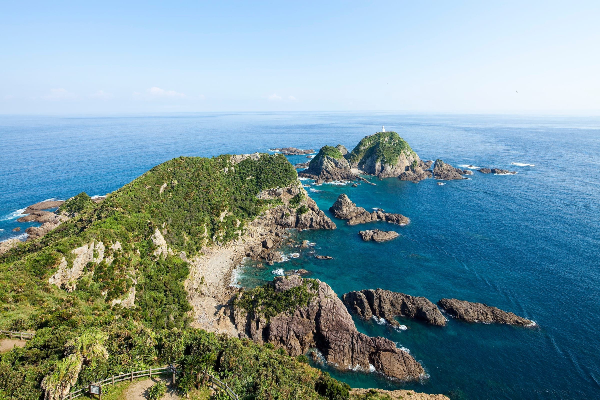
Photo Hajime NAKANO · Wikimedia Commons · CC BY 2.0 and others, credited in the gallery
HardPoint to pointRoad bike, Touring, E-bike
KonbiniDrinking waterToiletsBike shopsTop of chart 150 m
Routed over OpenStreetMap with BRouter trekking and measured against Copernicus DEM GLO-30 30 m on 2026-10-12. 9.4 km crosses bridges or water, where the elevation is drawn straight across. 1.2 km runs through tunnels, drawn straight through the hill.
On the road
- Surface
- Sealed. Along the seawalls the route switches back and forth between paths and ordinary roads, and the Iwaki Nanahama Kaido cycling road carries it along the Iwaki shore.
- Traffic
- MLIT's review found three sections where the route shares busy main roads with traffic and no separate bike space, and the council says warning signs and road markings are going in.
- Start
- Nakoso, Iwaki. The coast route starts at Nakoso in the far south of Iwaki. JR Iwaki Station and Iwaki Shinmaiko Heights serve as the southern gateways, with rental bikes.
- Finish
- JR Shinchi Station. Shinchi Station is the northern gateway, and Hotel Grad Shinchi beside it rents bikes and lends tools.
- In winter
- Hamadori gets very little snow by Fukushima standards, so the council says you can ride here for much of the year. It warns of ice on some road surfaces in winter.
Ride safely
- Some roads in the area remain closed to bicycles under evacuation orders. Stay on the signed route and check Fukushima's road and traffic restriction pages before riding.
- MLIT's review found four narrow tunnels on the route, and the council flags the crossing near Kanegasawa No. 1 Tunnel and the junction at the Nakoso-no-Seki entrance.
- MLIT's review found four stretches of long steep grades, and the council is adding signs and route-map notes for them.
- The council lists the Hisanohama, Numanouchi and Iwama disaster-prevention green belts as places to ride with care.
Every stop OpenStreetMap lists along the line (26): konbini, cafés, bike rental
- LawsonKonbinikm 21.4
- ふじみつKonbinikm 21.7
- CafésCaféskm 21.7
- 7-ElevenKonbinikm 30.8
- Shin Maiko Beach Cycle StationBike rentalkm 36.4
- TOAmartKonbinikm 46.1
- 7-ElevenKonbinikm 46.9
- 7-ElevenKonbinikm 48
- FamilyMartKonbinikm 48.8
- KohikanCaféskm 48.9
- タリーズコーヒーCaféskm 48.9
- NewDaysKonbinikm 48.9
- BREAKCaféskm 48.9
- FamilyMartKonbinikm 49.2
- LawsonKonbinikm 54.9
- 7-ElevenKonbinikm 65.3
- 海カフェCaféskm 65.4
- LawsonKonbinikm 78.9
- Sakura Station KINONEKonbinikm 97.3
- LawsonKonbinikm 104.9
- Key's CafeCaféskm 121.9
- FamilyMartKonbinikm 122.5
- 双葉町シェアサイクル 産業交流センターBike rentalkm 122.5
- ペンギンCaféskm 122.5
- 7-ElevenKonbinikm 172.2
- ラウンジバーCaféskm 176.3
From OpenStreetMap, within each kind’s reach of the line. Opening hours change; check before you rely on one.
Ways off the route
NakosoRail
JR Joban Line, near the start.
IwakiRail
JR Joban Line, the southern gateway station inland of the coast.
YotsukuraRail
JR Joban Line.
HironoRail
JR Joban Line, for J-Village.
TomiokaRail
JR Joban Line. Tomioka's tourism association rents bikes at the gateway here.
FutabaRail
JR Joban Line.
NamieRail
JR Joban Line.
HaranomachiRail
JR Joban Line.
SomaRail
JR Joban Line, for Matsukawaura.
ShinchiRail
JR Joban Line, the northern gateway.
OtsukoStation · km 0.2 · 1.9 km off the line
NakosoStation · km 3.1 · 547 m off the line
東日本旅客鉄道
UedaStation · km 8.9 · 603 m off the line
東日本旅客鉄道
IwakiStation · km 48.9
東日本旅客鉄道
KusanoStation · km 56.3 · 1.3 km off the line
YotsukuraStation · km 64.1 · 589 m off the line
HisanohamaStation · km 71.5 · 309 m off the line
東日本旅客鉄道
SuetsugiStation · km 75.9
東日本旅客鉄道
HironoStation · km 81.2 · 488 m off the line
東日本旅客鉄道
J-villageStation · km 85
東日本旅客鉄道
KidoStation · km 87.2 · 808 m off the line
東日本旅客鉄道
TatsutaStation · km 89.5 · 634 m off the line
東日本旅客鉄道
TomiokaStation · km 97.2
東日本旅客鉄道
YonomoriStation · km 102.1 · 940 m off the line
OnoStation · km 111.8 · 643 m off the line
東日本旅客鉄道
FutabaStation · km 120.7 · 349 m off the line
ShinchiStation · km 176.3
東日本旅客鉄道
Stations from OpenStreetMap within 2 km of the line. Check whether the line takes bikes before you plan to use it.
Tunnels
The line runs through 14 tunnels, 1.2 km in all; the longest is 200 m.
- Kanegasawa No. 1 TunnelThe council flags the crossing near this tunnel as a place to take care.
The route follows the Hamadori coast from Nakoso in Iwaki to Shinchi near the Miyagi border. It mixes seawall paths, the Iwaki Nanahama Kaido cycling road along Iwaki's beaches and quieter roads inland, and it became Tohoku's first National Cycle Route on 23 July 2026.
Fukushima calls a trip here hope tourism. Hamadori lived through the compound disaster of March 2011, and the route passes the places where the region tells that story itself. These include the Great East Japan Earthquake and Nuclear Disaster Memorial Museum in Futaba and the preserved Ukedo Elementary School in Namie, along with the Fukushima Reconstruction Memorial Park and J-Village.
Towns along the coast are open and want riders to stay. People from the gateway hotels and rental desks spoke at the council's September 2026 meeting, and they kept calling the designation a starting line for the route. The council invites you to come for the coast and the food as well as the recovery.
In the north the route skirts Matsukawaura lagoon near Soma, with Hama-no-Eki Matsukawaura for seafood, and in the south it runs past the Iwaki beaches and Aquamarine Fukushima. Look for Iwaki's mehikari fish on menus.
Worth knowing
- Ride north from Nakoso if you want the sea on your right and the Matsukawaura lagoon near the finish.
- Tomioka's tourism association rents bikes in the middle of the route, which makes a two-day ride with a train back easy.
Quick answers about Fukushima Hamadori Cycle Routeよくある質問
Can you cycle the whole Fukushima Hamadori coast?
Yes, on the signed route. Some other roads in the area stay closed to bicycles under evacuation orders, so keep to the Fukushima Hamadori Cycle Route and check the prefecture's road restriction pages first.
Where can you rent a bike for the Hamadori Cycle Route?
At the gateways. Shinchi's tourism association and Hotel Grad Shinchi rent bikes in the north, Tomioka's tourism association rents them in the middle, and Iwaki Shinmaiko Heights rents them in the south.
Can you ride the Hamadori coast in winter?
Usually. Hamadori gets very little snow by Fukushima standards, and the route council warns of ice on some roads in winter.
How long is the Fukushima Hamadori Cycle Route ride?
The Fukushima Hamadori Cycle Route ride is 176.3 km with 1,223 m of climbing by our route data, routed over OpenStreetMap and measured against Copernicus DEM GLO-30 30 m. The highest point is 109 m, and the steepest 200 m averages 16.2%.
Where can you buy food and water on the Fukushima Hamadori Cycle Route ride?
OpenStreetMap lists konbini at 16 points within reach of the Fukushima Hamadori Cycle Route line, and drinking water at none. The longest stretch without konbini is 49.7 km, so carry what you need for it.
In the journal and guides