Shimanto River Sinking Bridges from Ekawasaki
江川崎駅から3つの沈下橋をめぐるコース33°11′ N 132°47′ E18.4 km · 244 m up · 93% quiet roadsEasyCity bike, E-bike
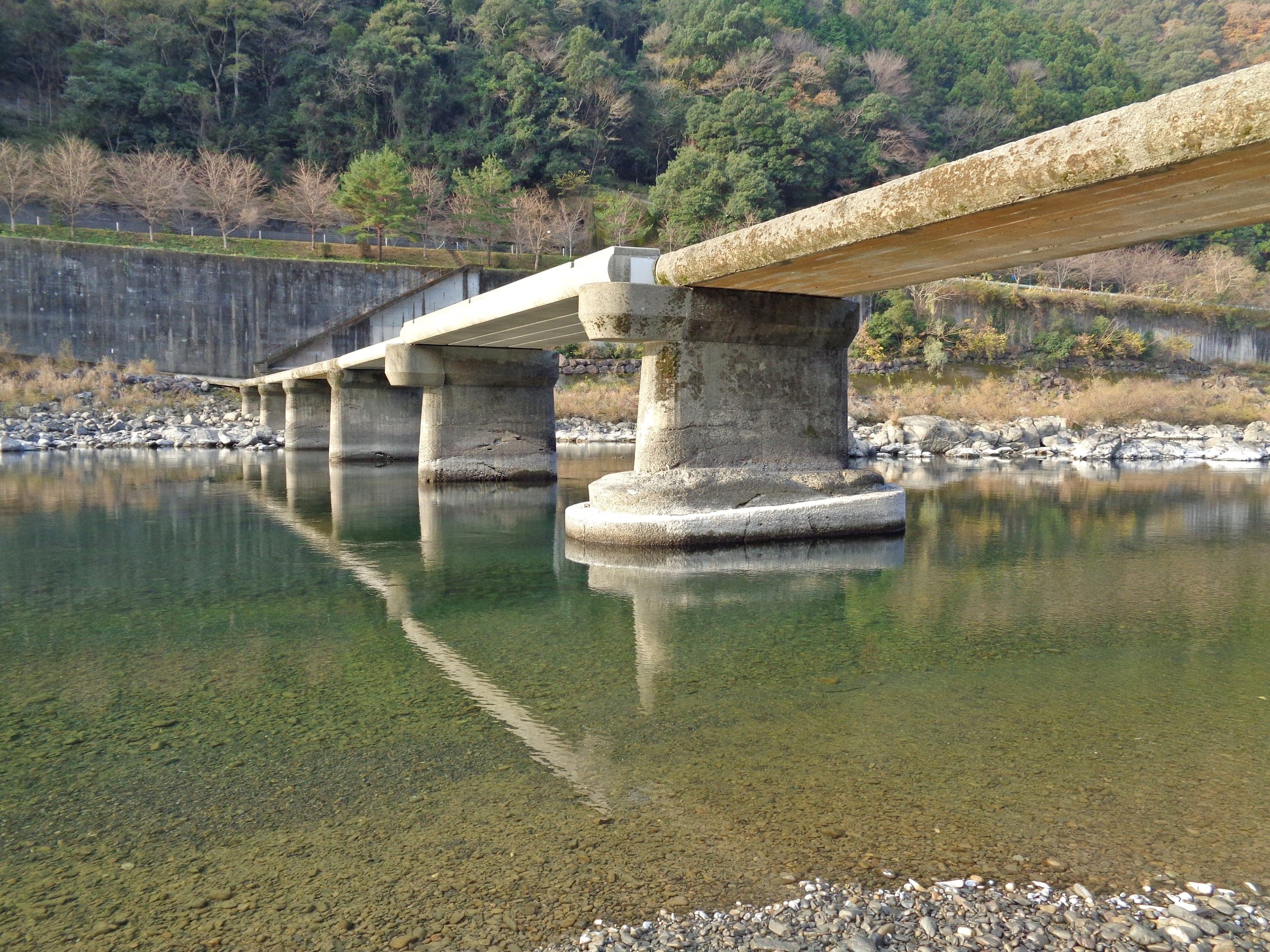
The Shimanto River sinking bridges course is a short out-and-back from JR Ekawasaki Station that the Shimanto tourism association publishes, and it suits families and easy riders who want three railing-free bridges in two hours; the trade-off is a narrow lane that keeps the pace slow.
Photo 四万十人 · Wikimedia Commons · CC BY-SA 3.0 and others, credited in the gallery
EasyOut and backCity bike, E-bike, Touring, Mountain bike
KonbiniDrinking waterToiletsBike shopsTop of chart 100 m
Routed over OpenStreetMap with BRouter trekking and measured against Copernicus DEM GLO-30 30 m on 2026-10-12. 1.3 km crosses bridges or water, where the elevation is drawn straight across. 0.1 km runs through tunnels, drawn straight through the hill.
On the road
- Start
- JR Ekawasaki Station. The Yodo Line station is where Shimanto's tourism association starts the course, and Canoe-kan's Rinrin Cycle lets riders return bikes at the station.
- In winter
- Canoe-kan's Rinrin Cycle closes from 29 December to 3 January, and the tourism association's own rental in Nakamura closed from 30 December 2025 to 3 January 2026.
Ride safely
- The sinking bridges have no railings. Walk the bike across if a car is coming the other way.
- The lane up the far bank from Canoe-kan is narrow and carries little traffic; the tourism association recommends taking it slowly.
Wind at Imabari, 1991-2020 normals
Which way to ride, month by month風
Jan
WSW 1.9
Either way
Feb
WSW 1.9
Either way
Mar
ENE 1.9
Either way
Apr
ENE 1.8
Either way
May
ENE 1.6
Either way
Jun
ENE 1.5
Either way
Jul
WNW 1.6
Either way
Aug
ENE 1.6
Either way
Sep
ENE 1.6
Either way
Oct
ENE 1.8
Either way
Nov
SSW 1.7
Either way
Dec
W 1.9
Either way
Arrows point the way the wind blows. Speeds are monthly means in m/s. The wind on any day can differ from the monthly pattern, so check the forecast.
Where to stop
Stops along the way寄り道
Shimanto Kawa-no-eki Canoe-kanCafe
The river station by the Nishitosa bridge runs the Rinrin Cycle rental.
Nagaoi sinking bridgeView
This is the first of the course's three sinking bridges.
Naka-Hage sinking bridgeView
Only people and bikes may cross it, and the high road bridge and the railway bridge stand in view.
Every stop OpenStreetMap lists along the line (6): bike rental
- 四万十川りんりんサイクルBike rentalkm 0
- 四万十川りんりんサイクルBike rentalkm 0.9
- 四万十川りんりんサイクルBike rentalkm 2.3
- 四万十川りんりんサイクルBike rentalkm 16.1
- 四万十川りんりんサイクルBike rentalkm 17.5
- 四万十川りんりんサイクルBike rentalkm 18.4
From OpenStreetMap, within each kind’s reach of the line. Opening hours change; check before you rely on one.
Ways off the route
EkawasakiRail
The JR Yodo Line stops here at the start.
HageRail
The JR Yodo Line stops here at the far end of the course.
NishigahōStation · km 0 · 1.8 km off the line
四国旅客鉄道
EkawasakiStation · km 0
四国旅客鉄道
HageStation · km 9.2
四国旅客鉄道
Stations from OpenStreetMap within 2 km of the line. Check whether the line takes bikes before you plan to use it.
Tunnels
The line runs through 2 tunnels, 0.1 km in all; the longest is 25 m.
Shimanto's tourism association sets this course in the middle reaches of the river from JR Ekawasaki Station, and it allows about two hours for the ride there and back. It crosses the bridge beside Canoe-kan and heads upstream on the far bank, on a narrow lane with little traffic, under trees as far as the Nagaoi and Naka-Hage sinking bridges.
Naka-Hage carries only people and bikes, and from the middle you look straight at the high road bridge and the railway bridge, so it's worth waiting for a train. The course carries on past the Kiminofuchi pool to the Hage sinking bridge. Beside it stands Hage Tenmangu, whose shrine gate frames the bridge, and at the autumn festival a bull-demon float called the ushi-oni crosses it.
Sinking bridges are the Shimanto's signature. They're built without railings so floods can pass over them, and in the rainy season they go under.
Worth knowing
- Rent from Canoe-kan's Rinrin Cycle if you want to drop the bike at Ekawasaki Station afterwards.
- Time your stop on Naka-Hage for a Yodo Line train crossing the railway bridge.
Quick answers about Shimanto River Sinking Bridges from Ekawasakiよくある質問
Can you cycle to the Shimanto River sinking bridges from a station?
Yes. Shimanto's tourism association publishes a course from JR Ekawasaki Station past the Nagaoi and Naka-Hage sinking bridges to the Hage bridge and Hage Tenmangu, and back, and it allows about two hours.
Why do the Shimanto River bridges have no railings?
So floods can pass over them. Shimanto's tourism association explains that the sinking bridges are built low and without railings so debris doesn't catch and the water flows over, and they go under in the heavy-rain season.
How long is the Shimanto River Sinking Bridges from Ekawasaki ride?
The Shimanto River Sinking Bridges from Ekawasaki ride is 18.4 km with 244 m of climbing by our route data, routed over OpenStreetMap and measured against Copernicus DEM GLO-30 30 m. The highest point is 88 m, and the steepest 200 m averages 16.4%.
Where can you buy food and water on the Shimanto River Sinking Bridges from Ekawasaki ride?
OpenStreetMap lists konbini at no point within reach of the Shimanto River Sinking Bridges from Ekawasaki line, and drinking water at none. The longest stretch without konbini is 18.4 km, so carry what you need for it.
Which way should you ride Shimanto River Sinking Bridges from Ekawasaki in April to May and October to November?
In April to May and October to November the most frequent wind at the nearest weather station blows from the east-north-east at about 1.7 m/s on average. By our calculation the Shimanto River Sinking Bridges from Ekawasaki ride finishes with less headwind either way.
Within 8 km
Places to stay nearby宿
Within 8 km